Mavic 4 Pro Field Report: Working Windy Corridors and Long
Mavic 4 Pro Field Report: Working Windy Corridors and Long Linear Routes with a Smarter Inspection Mindset
META: A field-driven look at how Mavic 4 Pro fits windy corridor work, pipeline-style route inspection logic, obstacle avoidance, ActiveTrack, D-Log capture, and practical third-party accessories.
When people talk about the Mavic 4 Pro, they usually drift toward image quality, flight intelligence, or whatever the newest headline feature happens to be. That misses the more interesting question: what kind of work does this aircraft actually make easier when conditions stop being polite?
I kept coming back to that question while thinking about windy field operations and long corridor flights. The reference material behind this piece is not a glossy consumer brochure. It is a pipeline application solution published in 2016 by Tianjin Tengyun Zhihang, a subsidiary of Hi-Target, and its framing still feels relevant today. It describes a hard reality: traditional oil and gas pipeline inspection relies on labor-heavy foot patrols, long inspection cycles, difficult access in mountainous terrain, and serious disruption when snow, floods, earthquakes, or landslides interfere. It also points out why the old alternatives were never fully satisfying. Satellite remote sensing can have a long revisit cycle and low resolution. Crewed aircraft bring high operating complexity and a messy airspace approval burden.
That is the real lens for evaluating a platform like the Mavic 4 Pro.
Not as a toy with pro branding. As a compact aircraft that can borrow the logic of industrial corridor inspection and apply it to civilian fieldwork where wind, distance, terrain, and visibility all matter.
Why the pipeline document matters to Mavic 4 Pro users
The source document mentions that China has hundreds of thousands of kilometers of active oil and gas pipeline spread across more than twenty provinces and coastal sea areas including the Bohai, Yellow, and South China seas. That number matters less as geography trivia than as an operational truth: linear infrastructure is unforgiving. A route can be long, repetitive, remote, and hard to reach. Problems hide in segments, not in central hubs.
That same pattern shows up far beyond pipeline work.
It appears in agricultural field edges, irrigation corridors, utility easements, drainage runs, access roads, construction boundaries, and rural logistics paths. If you are delivering across windy fields or surveying them for repeated operations, you are dealing with a version of the same challenge: cover distance efficiently, maintain situational awareness, capture usable data, and reduce the number of times a human has to physically push into rough terrain.
This is where the Mavic 4 Pro earns its place.
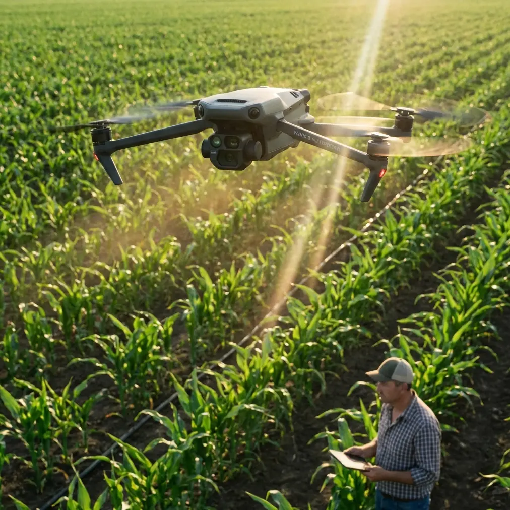
Wind changes everything, especially over open fields
Open fields create a false sense of simplicity. They look obstacle-light from the ground. In the air, they can be some of the most unstable environments for a compact drone. Wind rolls across them with very little friction. You get uneven gusts near tree lines, abrupt lateral pushes over irrigation cuts, and turbulence around structures that barely seem relevant from a distance.
For a photographer, this affects framing. For an operator doing corridor-style work, it affects mission confidence.
The reference document’s criticism of manual inspection being slow and dangerous in difficult terrain translates directly here. If your route requires repeated human traverses in muddy, flooded, snow-covered, or uneven ground, the cost is not just time. It is risk and inconsistency. A Mavic 4 Pro equipped with dependable obstacle avoidance and stable route discipline can turn a walking problem into a structured aerial pass.
That does not mean wind becomes irrelevant. It means the job becomes manageable.
In my own field workflow, obstacle avoidance is not just a safety feature to talk about in marketing copy. It is what lets me pay attention to the larger route logic when I am skirting low poles, isolated trees, irrigation rigs, and narrow edges between access tracks and cultivated areas. In windy conditions, small corrections become constant. The less mental bandwidth I spend on collision anxiety, the more I can spend on composition, line integrity, and route consistency.
Corridor work favors intelligent flight, not just raw flying skill
One of the underappreciated lessons from the pipeline solution is that inspection is not only about getting into the air. It is about repeatability and management. The extracted table of contents refers to pipeline construction safety detection, pipeline safety inspection, and intelligent scene management. That sequence is useful. First you document. Then you inspect. Then you organize the environment so decisions can be made faster next time.
The Mavic 4 Pro fits this progression well when used properly.
ActiveTrack and subject tracking are often discussed as cinematic tools, but in field conditions they can do something more practical: reduce pilot workload while following moving vehicles, utility carts, or personnel along predefined routes. If I am documenting a support vehicle crossing a field access road in gusty weather, subject tracking keeps the framing coherent while I monitor lateral drift and surrounding hazards. It is not about flashy footage. It is about preserving attention for the variables that matter.
QuickShots and Hyperlapse sound even less relevant to industrial-style work, but they have a place if you think like a documentarian rather than a casual flyer. A controlled Hyperlapse of a work corridor can reveal movement patterns, weather shifts, and changing visibility over time. QuickShots, used sparingly, can create standardized visual overviews for site updates. For a photographer like me, those tools become useful when they are disciplined. Not when they are decorative.
D-Log is more than a color choice in field documentation
There is also a quiet advantage in capturing footage in D-Log. Most people associate that with grading flexibility, and yes, that matters. But the operational significance is broader. Flat capture can preserve highlight and shadow detail in high-contrast environments where sunlit soil, reflective standing water, dark vegetation, and bright cloud breaks all coexist in the same frame.
That matters in windy field work because weather often refuses to stay stable.
If you are documenting route conditions before repeated deliveries or checking a corridor after heavy rain, image information matters more than visual punch straight out of the drone. D-Log gives you room to recover detail later and build a more accurate visual record. For inspection-adjacent work, that is not vanity. It is evidence quality.
The 2016 pipeline solution criticized satellite imagery for low resolution and long revisit intervals. Compact drones changed that equation by letting teams produce current, high-detail views on demand. The Mavic 4 Pro continues that shift. You can stand on site, launch, assess, and return with footage that is immediate enough to support action rather than just documentation.
A third-party accessory that genuinely helped
One upgrade that improved my windy-field workflow was a third-party landing pad with weighted edges and high-visibility markings. That sounds unremarkable until you launch repeatedly from rough ground.
In open agricultural areas, dust, loose chaff, cut stems, and damp soil are constant annoyances. A stable landing surface reduces contamination during takeoff and recovery, especially when prop wash starts kicking debris sideways in gusty air. The high-contrast surface also helps with quick visual setup when light is flat or the field has a lot of visual clutter.
This kind of accessory does not transform the aircraft, but it sharpens the operation. That distinction matters. Professionals rarely improve outcomes with one dramatic purchase. They improve them by removing friction at the margins.
I would put a quality sun hood for the controller in the same category. Windy work often comes with broken cloud and harsh glare, and if you cannot reliably read your screen, all the flight intelligence in the world becomes less useful.
Where Mavic 4 Pro sits between walking the route and overbuilding the mission
The source document draws a clear line between several legacy methods: walking patrols, satellite imaging, and crewed aircraft. That framework is still useful because the Mavic 4 Pro sits in the productive middle.
It is dramatically more immediate than waiting on satellite data with limited refresh timing. It is simpler and lighter than organizing a crewed aviation task. And it eliminates a substantial amount of ground exposure compared with sending people across every difficult section of a route.
That middle position is exactly why compact pro drones are so valuable for civilian operations.
Say you are planning repeated deliveries across windy field access lanes. Before you even think about payload routines or route timing, you need to understand obstructions, soft ground, local wind behavior, and terrain interruptions. A fast aerial reconnaissance pass with obstacle-aware flight and high-detail capture gives you a practical site picture. If there is standing water from recent flooding, if an embankment has shifted, if field machinery has changed the path geometry, you can see it immediately.
The pipeline document specifically mentions adverse events such as floods, snow, earthquakes, and landslides disrupting inspection work. While most field users are not dealing with all of those scenarios, the principle is universal: after environmental change, remote visual confirmation is often the smartest first step.
The real value is reduced uncertainty
People often ask whether a drone like the Mavic 4 Pro is “worth it” for field operations. I think that is the wrong framing. The better question is what kind of uncertainty it removes.
Does it reduce the need to physically enter every difficult area? Yes.
Does it shorten the cycle between noticing a potential issue and seeing it clearly? Yes.
Does it help maintain visual continuity along long, repetitive routes where problems are easy to miss from the ground? Absolutely.
That is why the old pipeline logic maps so well onto current drone practice. Linear work punishes blind spots. The Mavic 4 Pro, used with discipline, narrows them.
And discipline matters. Obstacle avoidance is not permission to get reckless near trees or wires. ActiveTrack is not a substitute for route planning. D-Log is not useful if your exposure is sloppy. Compact aircraft are most effective when they are flown with a systems mindset.
A photographer’s take on operational flying
My background is visual, not purely technical, so I notice something that gets overlooked in inspection conversations: clarity changes decisions.
When a field manager, site supervisor, or logistics planner can see a route from above with stable perspective, coherent motion, and enough detail to interpret surface conditions, conversations become shorter and better. You stop arguing from assumptions. You start adjusting based on evidence.
That may be the most practical reason to take the Mavic 4 Pro seriously for windy corridor work. It sits at the intersection of visual intelligence and operational efficiency.
If your use case is evolving from simple capture into structured field assessment, build your workflow around repeatable passes, careful screen visibility, solid launch-and-recovery habits, and post-processing that preserves detail rather than over-polishing it. If you need help matching the aircraft to that kind of work, this is a practical place to message a drone specialist.
The best field drone is not the one with the loudest spec sheet. It is the one that turns difficult ground, shifting weather, and long routes into manageable decisions. The older pipeline inspection playbook understood the problem clearly. The Mavic 4 Pro is compelling because it answers that problem in a much smaller, smarter package.
Ready for your own Mavic 4 Pro? Contact our team for expert consultation.