Mavic 4 Pro for Remote Coastline Delivery Work
Mavic 4 Pro for Remote Coastline Delivery Work: Why Flight Control Discipline Matters More Than Spec Sheets
META: A field-grounded look at how Mavic 4 Pro fits remote coastline delivery operations, with a focus on live monitoring, flight records, training, team control, and safer execution in difficult environments.
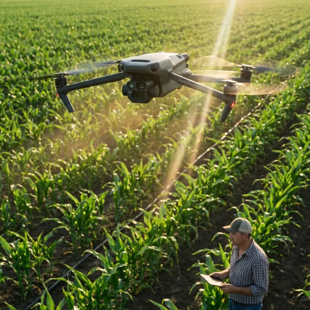
Remote coastline work exposes the difference between a drone that merely flies well and a drone operation that actually holds together under pressure.
Salt air, uneven terrain, interrupted line of sight, scattered landing options, and long transit legs over water all raise the cost of small mistakes. If you are using a Mavic 4 Pro for delivery support in remote coastal environments—moving light payloads, checking drop points, validating routes, or coordinating last-leg logistics—the airframe matters. But the bigger story is operational control. That is where many teams lose efficiency, and sometimes lose aircraft access windows entirely.
The most useful reference point here is not a glossy feature pitch. It is the workflow logic shown in DJI’s environmental gas-detection solution materials, especially the flight-control and team-management layers. Even though that source comes from an inspection context, the operational lessons transfer directly to coastline delivery missions: low-latency live view, real-time aircraft status awareness, intelligent flight support, precise flight reconstruction, simulation training, and multi-level backend management. Those functions are not side features. In remote work, they define whether the drone is a dependable field tool or just a camera that happens to move.
The real coastline problem is uncertainty
People often talk about remote coastal operations as if the main challenge is distance. Distance is only part of it.
The harder problem is uncertainty packed into every leg of a mission. Wind conditions can shift around cliffs and inlets. Terrain-following becomes more than a convenience when altitude relationships change abruptly along bluffs, roads, and access tracks. Visual confirmation of a drop zone or waypoint can be delayed by glare, mist, or shadow. If the pilot is also trying to track battery condition, positioning, signal quality, obstacle risk, and subject movement at the same time, the mission quickly becomes cluttered.
That is where the Mavic 4 Pro’s appeal becomes easier to understand in practical terms. Readers often focus on headline items like obstacle avoidance, ActiveTrack, QuickShots, Hyperlapse, or D-Log because those are familiar search terms and comparison points. They matter, especially for route documentation, terrain visualization, and maintaining lock on moving support vehicles or boats. But in remote coastline delivery scenarios, the real advantage comes when those flight features sit inside a disciplined control environment.
The source material highlights a 720P live HD video return with latency as low as 220 ms. That number is not trivial. On paper it sounds modest compared with the way consumer buyers think about resolution. In the field, however, low delay often matters more than visual bragging rights. If you are verifying whether a landing patch is clear, checking wave wash near a shoreline handoff point, or confirming that a ground team is in the correct position, an image that arrives too late can be more dangerous than an image that is merely less cinematic. Remote logistics work benefits from immediacy. A sub-second feedback loop helps pilots and coordinators make cleaner decisions, sooner.
Why Mavic 4 Pro makes more sense than competitors in this kind of work
A lot of competing drones look impressive in isolated categories. Some promise more aggressive autonomous behavior. Others lean hard into image specs or speed. But remote coastline delivery work is rarely won by a single flashy capability.
What separates a stronger platform is how well it lets the pilot and support team maintain situational awareness while the mission remains fluid.
The reference system emphasizes that the operator can see aircraft position, attitude, sensing status, remote-control link, transmission condition, battery, and camera information in one place. That is exactly the kind of integrated awareness that gives the Mavic 4 Pro an edge over competitors that may offer excellent imaging but weaker mission coherence. In a delivery-support context, obstacle avoidance is only as useful as the pilot’s confidence in the surrounding data picture. Subject tracking is only valuable if route, link, and battery decisions remain visible and understandable. ActiveTrack can follow movement; it cannot replace operational judgment. The better drone is the one that reduces decision fog.
That is why I would take a well-managed Mavic 4 Pro workflow over a theoretically stronger but fragmented competitor setup for remote coastal tasks. The best aircraft is not the one with the loudest brochure. It is the one that helps a field team stay synchronized when conditions stop being tidy.
Intelligent flight is more useful on the coast than many pilots admit
The source references several intelligent flight functions: intelligent follow, point-to-fly, terrain follow, point-of-interest orbit, hotspot follow, and return-home lock. Not every one of those will be used on a typical delivery support mission. That is not the point.
Their value is that they reduce repetitive control strain in environments where attention is expensive.
Take terrain follow. Along a coastline, route elevation can swing quickly. A pilot supporting package movement to a remote access point may need to parallel a cliff road, clear rock outcrops, or maintain safer stand-off over rising ground without constant manual micro-correction. Terrain-aware flight support cuts workload and preserves mental bandwidth for traffic checks, obstacle avoidance, and route confirmation.
Or consider point-to-fly logic in a scouting pass. If the drone is being used ahead of a delivery team to validate a path or check whether a handoff site is accessible, reducing the stick workload can improve consistency. This is especially useful when the mission is not about creative flying at all, but about repeatable observation.
Then there is return-home discipline. Coastal operations often involve patchy launch areas, strong reflective surfaces, and periods where the pilot must prioritize recovery over task completion. A reliable return logic is not glamorous. It is operational insurance.
Flight records are not paperwork. They are evidence.
One of the most practical details in the source is the emphasis on precise flight records that can reconstruct each flight through accurate trajectory and data. If you run remote coastline delivery support, this should immediately stand out.
Teams often treat logs as something for compliance after the fact. That is too narrow. Detailed replayable flight history has three concrete benefits.
First, it helps diagnose route inefficiency. If one coastal leg consistently consumes more time or battery than expected, the record shows whether the issue was detour behavior, wind exposure, pilot corrections, altitude management, or loitering near a handoff point.
Second, it improves incident review without guesswork. If a mission nearly ended in a low-battery return or obstacle close call, replaying the track and aircraft state helps turn a near-miss into a revised standard operating procedure.
Third, it makes team training measurable. You do not have to rely on subjective impressions of pilot quality. You can compare actual mission paths, control smoothness, time on task, and response patterns.
For coastline work, where each launch may require travel and weather timing, that kind of data continuity saves more than administrative time. It protects field days.
Simulation training deserves more attention than camera settings
The source also calls out simulated flight training in a safe, realistic environment. This is one of the most underused ideas in commercial drone operations.
Pilots preparing for remote coastline work should not be learning route behavior, handoff geometry, or emergency recovery logic live over water. They should be rehearsing mission patterns before the aircraft ever leaves the ground. That includes practicing how to handle a shifting visual horizon, route reversals, interrupted approaches, and changes in landing or drop-zone suitability.
The Mavic 4 Pro is often discussed through creative features like D-Log, Hyperlapse, and polished subject tracking. Those are valuable for mission documentation, progress reporting, and stakeholder communication. A logistics operator may need clean footage to show route accessibility, shoreline erosion, infrastructure condition, or delivery-point readiness. D-Log can preserve grading flexibility for detailed visual analysis; Hyperlapse can summarize environmental change over time; QuickShots may help with rapid contextual overviews in non-critical documentation passes.
But none of those should come ahead of training. Simulation matters because it turns features into habits. A drone with strong obstacle avoidance is helpful. A pilot trained to anticipate where obstacle avoidance might intervene is better.
Team management is where remote operations become scalable
The backend management details in the source are unusually relevant for any organization trying to use Mavic 4 Pro beyond solo flights.
The platform described includes three-tier management permissions, team-based aircraft binding, remote viewing of camera feeds and live states, and historical query tools for total flight time, total flight count, average flight duration, and recorded video materials. It also mentions support for up to four simultaneous remote drone video live streams.
This is not administrative decoration. It is the scaffolding for scale.
In a remote coastline delivery environment, one person may launch the aircraft, another may coordinate field movement, and a third may supervise task progress from elsewhere. If leadership can remotely check camera output, speed, GPS, and operator information, they can intervene early when a mission starts drifting off plan. If aircraft are bound to teams and permissions are structured properly, accountability improves. If flight histories and usage metrics are centralized, maintenance planning and pilot workload balancing become more realistic.
Support for four live drone streams is especially interesting. Even if many Mavic 4 Pro users will never operate that many aircraft at once, the concept matters. Multi-view remote oversight can transform a dispersed coastline project—one drone checking the route, another confirming the receiving site, another documenting infrastructure or environmental conditions—into a coordinated workflow instead of isolated flights.
If you want a practical discussion around integrating these workflows into your own operation, this is a useful place to start: message our UAV workflow team on WhatsApp.
A better way to think about Mavic 4 Pro for remote delivery
The usual online comparison format asks, “How far can it fly?” or “Is the camera better?” Those questions are incomplete.
For coastline delivery support, a smarter question is this: does the aircraft and its surrounding control system reduce uncertainty across the whole mission cycle?
The evidence from the referenced DJI workflow material points toward a stronger operational answer than many generic reviews provide. Low-latency 720P video return supports immediate route and landing-zone validation. A unified flight-status view reduces pilot overload. Intelligent flight functions such as terrain follow and return-home support cleaner execution in irregular coastal topography. Precise route reconstruction improves review, compliance, and training. Simulation closes the gap between feature availability and actual field competence. Backend management with role-based permissions and remote monitoring turns a single-aircraft habit into a team operation.
That is why the Mavic 4 Pro stands out here. Not because it is magical, and not because every automated feature should be trusted blindly. It stands out because, when matched with disciplined control software and team procedures, it can serve as a serious node in remote logistics work rather than a one-person flying gadget.
On a coastline, that distinction shows up fast. The teams that stay efficient are rarely the ones with the most dramatic marketing specs. They are the teams that can see what the aircraft is doing, understand why it is doing it, replay what happened after the flight, and train the next mission before conditions turn difficult again.
That is the difference between flying a capable drone and running a capable drone operation.
Ready for your own Mavic 4 Pro? Contact our team for expert consultation.