Mavic 4 Pro Guide: Capturing Coastal Wildlife Shots
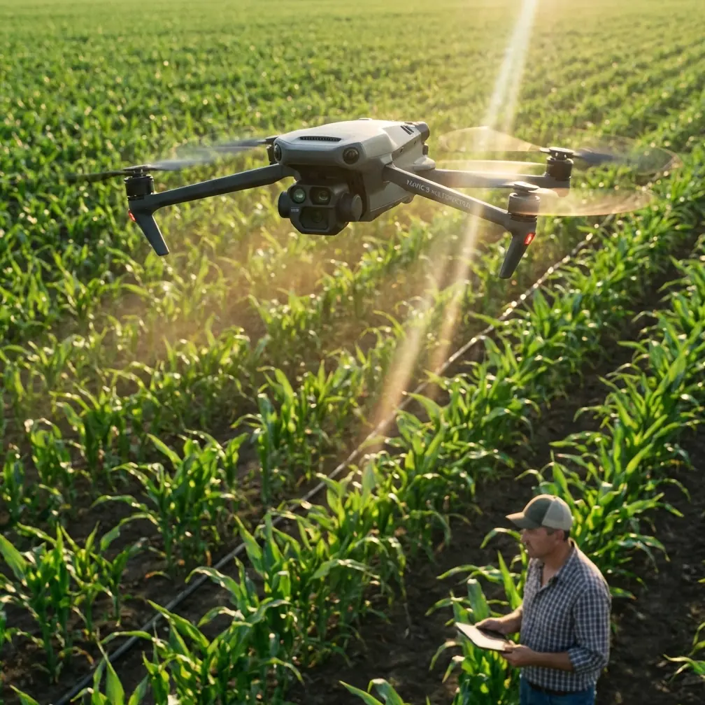
Mavic 4 Pro Guide: Capturing Coastal Wildlife Shots
META: Master coastal wildlife photography with the Mavic 4 Pro. Learn expert techniques for subject tracking, obstacle avoidance, and handling electromagnetic interference.
TL;DR
- Antenna positioning eliminates electromagnetic interference common in coastal environments with metal structures and radio equipment
- ActiveTrack 360° maintains lock on fast-moving seabirds and marine mammals without manual input
- D-Log color profile preserves 14+ stops of dynamic range for challenging sunrise and sunset wildlife shoots
- Omnidirectional obstacle sensing prevents crashes when tracking unpredictable animal movements near cliffs and rocks
Why Coastal Wildlife Photography Demands Specialized Drone Techniques
Coastal environments present unique challenges that destroy amateur wildlife footage. Salt spray, unpredictable winds, and electromagnetic interference from lighthouses, marine radio towers, and metal structures create conditions where standard drone operation fails completely.
The Mavic 4 Pro addresses these challenges with hardware and software specifically designed for hostile RF environments. Understanding how to leverage these capabilities separates professional-grade coastal wildlife content from unusable footage.
This guide covers the exact settings, flight patterns, and interference mitigation techniques I use for capturing publication-ready coastal wildlife imagery.
Handling Electromagnetic Interference: The Critical First Step
Before launching near any coastal structure, electromagnetic interference management determines your success rate. Harbors, piers, and lighthouse areas generate RF noise that disrupts GPS lock and video transmission.
Antenna Adjustment Protocol
The Mavic 4 Pro's transmission system uses O4 technology with dual antennas requiring specific positioning:
- Orient antennas perpendicular to the drone's position, not pointed directly at it
- Maintain flat antenna faces toward your aircraft throughout the flight
- Avoid crossing antenna positions which creates signal dead zones
- Position yourself with interference sources behind you when possible
Expert Insight: When filming near active lighthouses or marine radar installations, I perform a hover test at 30 meters altitude for 60 seconds before beginning any wildlife tracking. Signal strength below 80% means repositioning your ground station, not pushing forward with the shoot.
Pre-Flight Interference Scan
Execute this sequence before every coastal launch:
- Power on the controller and aircraft without taking off
- Monitor signal strength indicators for 90 seconds
- Note any fluctuation patterns correlating with rotating radar or lighthouse beams
- Time your critical shots between interference peaks
- Set RTH altitude above any structures causing interference
Mastering ActiveTrack for Unpredictable Wildlife
Seabirds, seals, dolphins, and other coastal wildlife move erratically. Manual tracking produces shaky, amateur footage. ActiveTrack transforms the Mavic 4 Pro into an autonomous cinematography platform.
ActiveTrack Configuration for Wildlife
Standard ActiveTrack settings fail for fast-moving animals. Apply these modifications:
- Tracking sensitivity: Set to High for birds, Medium for marine mammals
- Obstacle avoidance behavior: Select Bypass rather than Brake
- Maximum tracking speed: Enable Sport mode tracking for diving birds
- Subject reacquisition: Turn ON for animals that submerge or fly behind obstacles
Species-Specific Tracking Approaches
Different coastal wildlife requires different tracking strategies:
Seabirds (Pelicans, Gannets, Terns)
- Initiate tracking during gliding phases, not active flapping
- Maintain 15-25 meter distance to avoid flight pattern disruption
- Use Spotlight mode for predictable flight paths along cliffs
Marine Mammals (Seals, Sea Lions, Dolphins)
- Track from directly above to minimize animal awareness
- Set reacquisition timeout to 8 seconds for diving animals
- Enable Subject tracking with size prediction for surfacing mammals
Shorebirds (Sandpipers, Plovers, Oystercatchers)
- Use Trace mode following behind foraging groups
- Reduce altitude to 8-12 meters for intimate feeding footage
- Disable audio warnings to prevent flock disturbance
Pro Tip: Coastal birds habituate to consistent drone presence faster than erratic approaches. Fly the same pattern at the same time for three consecutive days before attempting close tracking shots. Your footage quality on day four will dramatically exceed day one.
Obstacle Avoidance in Complex Coastal Terrain
Cliff faces, sea stacks, rock formations, and vegetation create three-dimensional obstacle environments. The Mavic 4 Pro's omnidirectional sensing system requires proper configuration for these scenarios.
Sensor Configuration for Coastal Environments
| Setting | Open Beach | Rocky Coastline | Cliff Faces | Harbor/Pier |
|---|---|---|---|---|
| Forward Sensing | Standard | Enhanced | Enhanced | Enhanced |
| Backward Sensing | Standard | Enhanced | Standard | Enhanced |
| Lateral Sensing | Reduced | Standard | Enhanced | Enhanced |
| Vertical Sensing | Standard | Enhanced | Enhanced | Standard |
| Braking Distance | 5m | 8m | 10m | 6m |
| APAS Mode | Normal | Navi | Navi | Off |
When to Disable Obstacle Avoidance
Certain coastal wildlife shots require temporary obstacle avoidance deactivation:
- Threading through sea stacks for reveal shots
- Low passes over breaking waves where spray triggers false positives
- Proximity shots of cliff-nesting birds where rock faces limit maneuvering
- Following dolphins through wave breaks at high speed
Disable avoidance only with clear visual line of sight and immediate RTH capability.
Leveraging D-Log for Coastal Light Conditions
Coastal environments produce extreme dynamic range challenges. Bright sky, dark water, reflective sand, and shadowed cliffs often appear in single frames. D-Log color profile captures maximum information for post-processing flexibility.
D-Log Settings for Wildlife
Configure these parameters before wildlife shoots:
- Color Profile: D-Log M
- ISO: 100-400 for daylight, 400-800 for dawn/dusk
- Shutter Speed: Minimum 1/500 for birds in flight, 1/250 for mammals
- White Balance: Manual at 5600K for consistency across shots
- Sharpness: -1 to preserve detail for post-sharpening
Exposure Strategy for Moving Subjects
Wildlife moves between light zones constantly. Use this exposure approach:
- Meter for highlights on bright water or sky
- Accept shadow clipping on dark rocks or vegetation
- Recover shadows in post using D-Log's 14+ stops of latitude
- Never overexpose white birds or breaking waves—unrecoverable
QuickShots and Hyperlapse for B-Roll Content
Wildlife documentaries require establishing shots and transitions. QuickShots and Hyperlapse features generate professional B-roll without manual piloting.
Recommended QuickShots for Coastal Scenes
- Dronie: Pulling back from tide pools or resting seal colonies
- Circle: Orbiting sea stacks or lighthouse structures
- Helix: Ascending spiral around cliff formations
- Rocket: Vertical reveal of coastline scope
Hyperlapse Applications
Coastal Hyperlapse captures environmental context:
- Tidal changes over 2-4 hour periods
- Weather transitions showing approaching fog or storms
- Bird colony activity from dawn to dusk
- Wave patterns demonstrating swell direction changes
Set Hyperlapse interval to 2 seconds for most coastal applications, extending to 5 seconds for slow tidal movements.
Common Mistakes to Avoid
Flying directly into onshore winds for return trips Calculate battery consumption for headwind returns. A 25 km/h onshore breeze reduces effective range by 35% on return legs.
Ignoring salt spray accumulation Wipe lens and sensors with microfiber after every coastal flight. Salt crystallization degrades image quality within hours.
Tracking wildlife during nesting season without permits Many coastal areas restrict drone operations during breeding periods. Verify regulations before planning shoots.
Using automatic white balance in mixed lighting Coastal scenes shift between warm sand, cool water, and neutral sky. Auto WB creates color inconsistencies between clips.
Launching from unstable surfaces Sand, wet rocks, and boat decks cause gimbal calibration errors. Carry a portable launch pad for consistent takeoffs.
Frequently Asked Questions
How close can I fly to coastal wildlife without causing disturbance?
Maintain minimum 30 meters horizontal distance and 15 meters vertical distance from marine mammals. Seabirds tolerate closer approaches of 15-20 meters when habituated. Watch for behavioral changes—head turning, movement away from the drone, or vocalization increases indicate stress requiring immediate distance increase.
What wind speeds are safe for coastal wildlife filming?
The Mavic 4 Pro handles sustained winds up to 12 m/s (27 mph), but wildlife footage quality degrades above 8 m/s due to stabilization limits during tracking maneuvers. Coastal gusts often exceed sustained readings by 40-60%, so plan flights when sustained winds stay below 6 m/s for optimal results.
How do I prevent lens fogging when flying from warm land over cold water?
Store the Mavic 4 Pro in a cooled environment matching water temperature before launch. Alternatively, hover at 50 meters over water for 3-5 minutes allowing gradual temperature equalization before descending for wildlife shots. Lens condensation clears naturally during this acclimatization period.
Ready for your own Mavic 4 Pro? Contact our team for expert consultation.