Mavic 4 Pro in the Vineyard at Dusk: A Field Report on Low
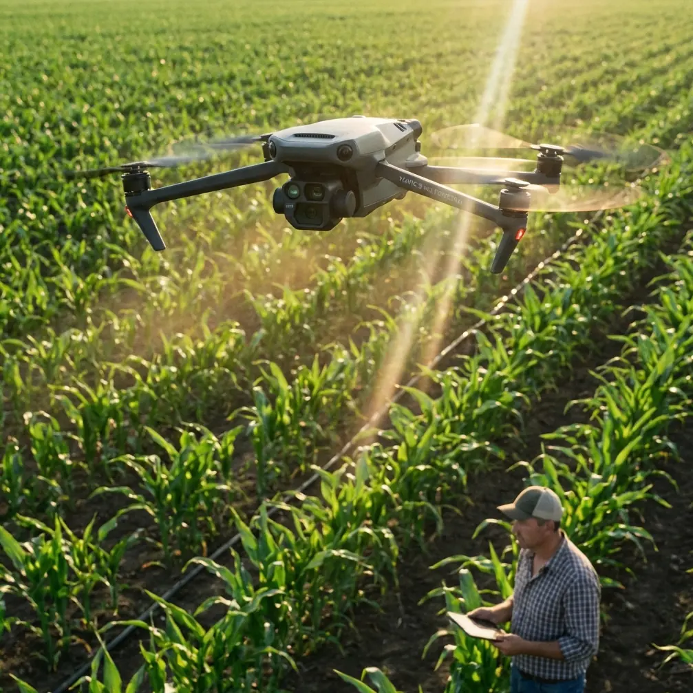
Mavic 4 Pro in the Vineyard at Dusk: A Field Report on Low-Light Mapping, Motion, and Safer Altitude Choices
META: A field-tested look at using Mavic 4 Pro for low-light vineyard capture, with practical altitude advice, obstacle awareness, tracking workflow, D-Log considerations, and lessons drawn from professional UAV mapping methods.
Late light in a vineyard is deceptive.
To the eye, it feels generous: long rows glowing gold, shadows carving shape into the terrain, trellis lines pulling the landscape into order. To a drone sensor, it is a narrower window. Contrast rises fast. Dark canopy gaps swallow detail. The geometry of repeating vine rows can make orientation trickier than many pilots expect, especially when the terrain rolls gently and the flight path stretches beyond one block.
That is exactly why the Mavic 4 Pro deserves to be discussed in a more serious way than a simple camera-drone roundup. For vineyard work in low light, this aircraft is not just about pretty aerials. It sits at the intersection of two disciplines that often get treated separately: creative image-making and structured aerial survey logic.
I’ve been thinking about that overlap while reviewing a Chinese UAV surveying solution describing how professional teams approach large-scale topographic output and 3D reconstruction. One workflow uses a fixed-wing platform, the iFly U3, paired with a Sony A7r to capture high-resolution aerial imagery plus POS data for large-scale topographic map production. Another uses a multirotor, the iFly D1, carrying an oblique camera called the iCam Q5 to collect multi-view imagery for 3D city reconstruction. Different aircraft, different goals, same core lesson: image collection strategy matters as much as the camera.
That principle carries directly into a vineyard evening flight with Mavic 4 Pro.
Why vineyard flying at dusk is harder than it looks
Vineyards create a seductive but punishing scene for aerial capture. Rows are repetitive. Shadows between vines deepen quickly. Utility lines, end posts, netting systems, and nearby tree lines can hide in low-contrast conditions. If the land steps up or down across the property, the drone’s apparent clearance can change more than the live view suggests.
This is where obstacle avoidance earns its keep. In broad daylight, pilots sometimes treat sensing as a backup. In low light over agriculture, it becomes part of the mission plan. The practical value is not only crash prevention. It reduces mental load, which leaves more attention for framing, exposure, and flight consistency.
And consistency matters. Survey teams do not collect data casually. The reference material describes a sequence: inspect the terrain first, plan the route, then fly. Only after that do they process for usable outputs. That order is worth borrowing even when the goal is a cinematic vineyard sequence rather than a map sheet.
With Mavic 4 Pro, I’d apply the same discipline. Walk the field edge before takeoff. Identify height changes, poles, cables, isolated trees, and irrigation structures. Check where the last light is falling. Decide whether the priority is row symmetry, parcel context, or moving subject work such as a tractor return, a picker team wrap-up, or a utility vehicle crossing between blocks.
The best vineyard flights happen before the props spin.
The most useful altitude insight for this scenario
If you want one practical number, start at 35 to 45 meters above ground level for low-light vineyard capture.
That band is a sweet spot for a few reasons.
At that height, vine rows still read clearly as structure rather than texture. You preserve the pattern that gives vineyards their graphic power, but you stay low enough for the side light to reveal canopy shape. Drop much lower and the frame can become too busy, especially near end posts and service lanes. Climb much higher and the image starts flattening out, which weakens the dusk mood and makes the rows blend together.
There is another operational reason. In fading light, obstacle avoidance and pilot visual judgment both benefit from maintaining a moderate buffer above trellis systems, farm equipment, and marginally visible wires near access roads. A 35 to 45 meter working altitude often gives you enough clearance to move laterally with confidence while still retaining strong subject separation.
If the terrain undulates, think in terms of consistent height above the canopy, not just a single takeoff-point altitude. That echoes the survey mindset in the source material. Large-scale topographic work depends on route planning because terrain shape directly affects data quality. In a vineyard, terrain shape affects visual consistency and safety. A row-following pass that looks perfect at one end can become too low over a rising block twenty seconds later.
For establishing shots, I often step up to around 55 to 70 meters to reveal block geometry and property context. For hero passes through leading rows at dusk, I come back down into that 35 to 45 meter zone.
What mapping workflows teach us about better vineyard footage
The source document defines large-scale topographic maps as those typically in the 1:500 to 1:5000 range, with a stated precision benefit from UAV systems reaching centimeter-level data accuracy. On the surface, that sounds unrelated to storytelling. It is not.
The significance is operational: professionals use drones not only because they fly, but because they gather repeatable, high-quality spatial information efficiently. The document even stresses that UAV systems cut traditional field labor costs and greatly improve efficiency. For vineyard media work, that same logic translates into more reliable repeat passes, cleaner geometry, and easier comparison across shoots.
Say a winery wants four dusk captures over the growing season, or wants footage aligned with irrigation, canopy management, or harvest timing. A disciplined Mavic 4 Pro workflow inspired by mapping practice makes the result much more useful. Fly similar paths. Maintain repeatable heights. Keep camera behavior consistent. Capture a broad establishing orbit, a row-aligned lateral, and a forward reveal over each block. This is not bureaucratic thinking; it is how you turn beautiful footage into a usable visual record.
The 3D reconstruction section of the reference is equally relevant. The iFly D1 with the iCam Q5 collects multi-view aerial images plus corresponding POS data, then software processes those into a 3D scene. Why does that matter for a vineyard photographer? Because vineyards benefit enormously from varied viewing angles in low light. A straight overhead can show row spacing, but it hides volume. A shallow oblique view reveals terrain relief, canopy mass, service roads, and how light is washing across the property.
So if I were planning a Mavic 4 Pro dusk session, I would not just shoot one hero angle. I would think like an oblique capture operator: top-down references, moderate obliques, and a few lower-angle reveals that show the rows stepping into the distance. Even if you never build a 3D model, the multi-angle discipline improves the story.
D-Log in a vineyard is not about fashion
A lot of pilots treat D-Log as a badge rather than a tool. In vineyards at dusk, it is a tool.
You are trying to hold detail in bright sky slashes while keeping information in dark green canopies and shaded inter-row ground. That tonal spread is where a flatter profile helps. D-Log gives you more room to manage the scene later without letting highlights clip too early or letting shadows collapse into murk.
But low light is also where sloppy exposure decisions show up fast. Underexpose too much chasing sky detail and the rows become noisy. Expose too far right and the pale dust roads or reflective trellis elements can jump out unnaturally. The better approach is to expose for the vineyard first, especially if the land itself is the subject, and accept that the brightest band near the horizon may need gentle restraint in grading rather than total preservation in-camera.
This is one of those places where Mavic 4 Pro’s professional positioning matters. The aircraft is not simply helping you see the vineyard. It is helping you hold together the visual relationship between landform, crop structure, and evening atmosphere.
ActiveTrack and subject tracking: useful, but not the whole plan
If there is a moving subject in the scene, a vineyard truck on a lane, a worker cart, a small tractor heading back to the shed, ActiveTrack can save the shot. Subject tracking is especially valuable when rows are converging visually and the background is changing quickly as light falls. It lets you concentrate on altitude, edge spacing, and the rhythm of the pass rather than manually correcting every framing drift.
Still, I would not build the session around tracking alone.
Vineyards are full of repeating lines, partial occlusions, and sudden changes in contrast. Tracking is strongest when the path is obvious and the subject remains visually distinct. It is weaker when the subject crosses from bright lane to shadow, disappears briefly behind a tree line, or becomes too similar in tone to the ground. My rule is simple: use ActiveTrack to reduce workload, not to replace route design.
The survey reference again offers the right mindset. Their process starts with reconnaissance and flight path planning before data collection. For Mavic 4 Pro vineyard work, that means deciding where tracking is genuinely helpful and where a manual, pre-visualized line will produce the cleaner result.
QuickShots and Hyperlapse in a vineyard: where they actually fit
QuickShots can be useful in vineyards, but only if you are selective. At dusk, automated motion can look fantastic when the rows and surrounding landscape are simple and the air is calm. It can also produce generic movement that ignores the geometry of the site.
The better use is to deploy QuickShots only when the pattern of the vineyard supports the motion. A carefully placed pullback from an end row, or a rise-and-reveal over a crest, can work beautifully. The key is that the automation should serve the structure already present in the field.
Hyperlapse is different. Vineyards can be superb hyperlapse subjects because the evening transition is visible both in the sky and on the ground. Long shadows creep, service roads cool off in tone, and rows gradually lose their specular highlights. If you choose a stable vantage and enough altitude to keep row pattern legible, the result can say more about a vineyard’s atmosphere than a conventional clip.
Again, moderate altitude is the hinge. Too low, and the frame becomes twitchy and over-detailed. Too high, and you lose the intimate agricultural character.
The hidden relevance of centimeter-level thinking
The source document’s claim of centimeter-level accuracy for UAV-derived outputs may sound far from artistic flying, but it hints at something Mavic 4 Pro users should care about: disciplined spatial awareness.
In vineyards, small positional changes matter. Shift a lateral pass just a few meters and the rhythm of the rows changes. Climb slightly and shadow spacing changes. Tilt a bit more and the hillside suddenly reads as flat. The more precisely you manage position and altitude, the more refined the final footage becomes.
This is why I recommend treating even a creative shoot like a light mapping mission. Log your best altitudes. Note row direction relative to sunset. Keep a record of where obstacle density rises. Save your most effective route as a repeatable pattern. If you want to compare approaches for a specific property, talk shop with other operators or local pilots through a practical chat link like this WhatsApp contact for flight planning questions.
The goal is not bureaucracy. The goal is repeatability in a scene that changes minute by minute.
A field workflow I’d use with Mavic 4 Pro in this exact scenario
For a vineyard at low light, my sequence would look like this:
First, walk and observe. Borrowing directly from the surveying playbook, inspect the terrain before launch. You are looking for elevation changes, obstructions, and the light direction that best defines row structure.
Second, establish the mapping view. Fly a clean, moderate-height pass around 55 to 70 meters to understand the property and secure context shots.
Third, move into the working band. Capture your strongest row-based footage at 35 to 45 meters above ground level. This usually gives the best balance of row definition, canopy shape, and obstacle margin.
Fourth, add oblique variants. The 3D reconstruction workflow in the source relies on multi-view imagery because one angle is never enough. The same is true here. Shoot top-down references, then oblique reveals that show terrain and spacing.
Fifth, use D-Log deliberately. Preserve the mood, but protect enough shadow information to keep the vineyard readable in post.
Sixth, deploy tracking only where the route supports it. ActiveTrack works best when the lane is clear, the subject stands out, and the vineyard’s repeating geometry will not confuse the framing.
Seventh, finish with one restrained Hyperlapse or a single well-chosen QuickShot rather than ten automated variations.
That is how you keep the session coherent.
Why Mavic 4 Pro suits this work
What makes the Mavic 4 Pro especially compelling for vineyard dusk capture is not one feature in isolation. It is the combination: obstacle awareness that matters in low-contrast agricultural space, subject tracking that can assist moving farm scenes, D-Log flexibility for high-contrast evening light, and the ability to move between broad reconnaissance-style shots and tighter visual storytelling without changing platforms.
The reference materials describe specialized aircraft for specialized jobs: a fixed-wing platform for efficient high-resolution area capture and a multirotor with an oblique camera for dense multi-view reconstruction. Mavic 4 Pro is not replacing those dedicated survey systems in formal mapping work. But for a vineyard operator, photographer, or estate marketing team, it borrows from both worlds. It can think wide like a survey mission and shoot expressive like a camera drone.
That blend is exactly what low-light vineyard work demands.
The best result comes when you stop treating dusk as merely a pretty time of day and start treating it as a narrow operational envelope. Plan the route. Respect the terrain. Work in the right altitude band. Let the rows do the visual heavy lifting. And use the aircraft’s intelligent tools as support, not as a substitute for judgment.
Ready for your own Mavic 4 Pro? Contact our team for expert consultation.