Capturing Vineyards in Urban Areas With the Mavic 4 Pro
Capturing Vineyards in Urban Areas With the Mavic 4 Pro: A Practical Field Approach
META: A photographer’s practical guide to using the Mavic 4 Pro for vineyard filming in urban environments, with antenna positioning, obstacle avoidance, tracking, D-Log, and flight-planning tips.
Urban vineyard work is not the same as flying over a rural estate with open sky on every side. The subject may still be rows of vines, textured soil, and geometric leading lines, but the airspace feels tighter. Rooftops interrupt the horizon. Light poles, trees, wires, and reflective glass create visual clutter. Signal behavior changes. So does risk.
That is exactly where the Mavic 4 Pro becomes interesting.
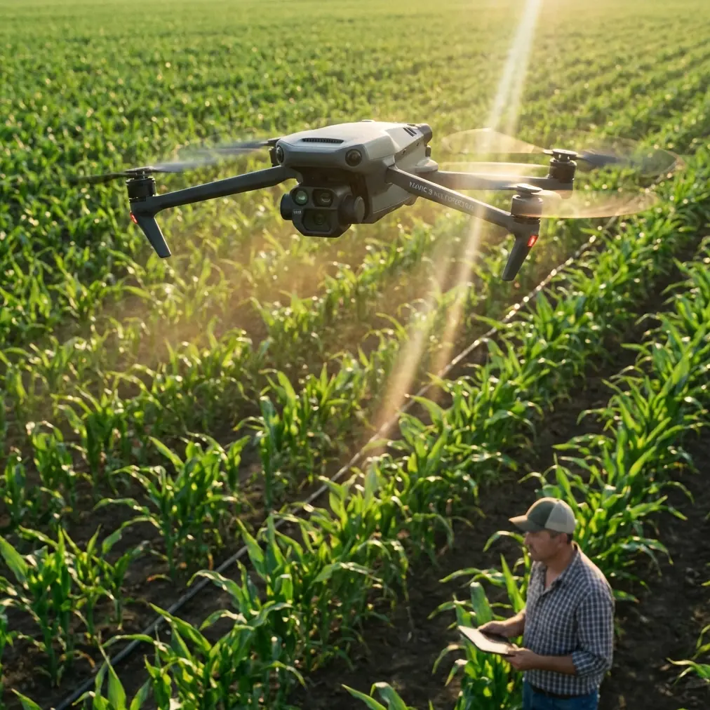
I approach this as a photographer first. When I’m asked to capture vineyards in or near built-up areas, I’m not looking for a drone that only performs well on a clean marketing set. I need one that can keep the image elegant while helping me manage a compressed environment. The Mavic 4 Pro is especially strong here because the conversation is not just about image quality. It is about how camera tools, obstacle sensing, subject tracking, and transmission habits work together when the vineyard is surrounded by roads, walls, utility lines, and nearby structures.
The problem is simple to describe: vineyards in urban settings are visually beautiful but operationally messy.
Rows of vines create strong patterns, especially at low altitude and during side light. Yet the same shot can become difficult when the route between the launch point and subject passes close to buildings or the aircraft has to skim above trellises while maintaining smooth tracking. Add even mild RF interference from city infrastructure, and range confidence can disappear faster than most pilots expect. You may still have enough link budget on paper, but the real bottleneck becomes antenna orientation, line of sight discipline, and how intelligently you plan the shot.
That is where the Mavic 4 Pro’s practical toolset matters most.
Let’s start with the image side, because vineyard work lives or dies by tonal control. Vines are full of repetitive fine detail. Leaves can shimmer or break apart if exposure is not managed carefully. If you’re shooting in strong afternoon sun, bright sky and dark earth can force a compromise unless you preserve grading flexibility. Recording in D-Log gives you room to hold highlight structure in the sky while keeping the rows readable in shadow. That is not a theoretical advantage. In vineyard scenes, the difference shows up immediately in the subtle separation between green leaf layers, dusty paths, and reflective irrigation hardware. A flatter capture profile also helps when moving from a broad reveal shot into a lower pass where the scene contrast changes quickly.
But image latitude only matters if the aircraft can move cleanly.
Urban vineyard shoots often call for tracking movement through constrained spaces: a utility cart between rows, a walking winemaker, or a slow lateral pass that keeps the symmetry of the vineyard intact while nearby buildings sit just outside frame. This is where ActiveTrack and obstacle avoidance stop being buzzwords and start becoming useful operational tools. Subject tracking is valuable not because it replaces piloting, but because it lowers workload when framing and path refinement need to happen at the same time. If your subject is moving at a steady pace through a lane between vines, ActiveTrack can help preserve composition while you focus on altitude, speed discipline, and the changing background.
Obstacle avoidance becomes even more relevant in this scenario. In an urban vineyard, the obvious hazards are not always the most dangerous ones. Trellis lines, poles, fences, edge trees, and sudden elevation changes can creep into a route that looked clear from the takeoff point. A drone with robust sensing gives you a wider safety margin when you are flying a low reveal or curving around a boundary line to show the contrast between cultivated vineyard geometry and surrounding city texture. It does not make the flight automatic, and it should never be treated that way, but it can reduce the chance that a small framing adjustment turns into a large mistake.
That brings me to antenna positioning, which is one of the least glamorous and most important parts of getting reliable range in this environment.
Pilots often think of range as a fixed specification. In practice, urban vineyard work exposes how conditional that assumption is. The controller antennas need to be oriented so their broadside faces the aircraft, not the tips pointed at it. That sounds basic, but it is the kind of habit that separates a calm flight from a choppy one. If the drone is flying out across the vineyard at medium altitude, don’t angle your controller absentmindedly toward the ground monitor and forget the antenna geometry. Reposition your body and the controller together so the flat faces of the antennas are presented toward the aircraft’s path. Small adjustments can make a noticeable difference in signal stability.
Line of sight matters just as much. If a building corner, a dense stand of trees, or even a parked truck starts to intrude between you and the aircraft, transmission quality can degrade before you realize what changed. In an urban vineyard, I often choose a launch point that is less visually dramatic but far better for maintaining a clean radio path. A few meters of elevation at the takeoff location can be worth more than a more central position. If I can stand on a slight rise, an open terrace, or a clear edge road with unobstructed sightlines down the rows, I will usually take that option every time.
There is a second reason antenna discipline matters with the Mavic 4 Pro in this use case: the shots people want are often long, slow, and deceptively demanding. A vineyard reveal is rarely a quick sprint away from the operator. More often it is a measured push, a rising diagonal, or a gentle orbit where the aircraft remains in the air long enough for interference patterns and orientation mistakes to show up. If you are filming a Hyperlapse sequence over an urban vineyard edge, consistency matters even more. Tiny link disruptions, unnecessary braking, or path corrections can make an otherwise beautiful time-compressed sequence feel unstable.
Hyperlapse is especially effective in this setting because vineyards in urban zones often have a visual duality you can exploit: organic rows in the foreground, structured city life in the distance. Moving clouds, changing traffic flow, and shifting shadow lines can all add dimension. The trick is to choose movement that respects the geometry of the site. I prefer a slow, deliberate slide or rise rather than an aggressive arc. The vineyard itself already provides rhythm. The aircraft should support that rhythm, not compete with it.
QuickShots also have a place here, though I use them selectively. In a dense environment, automated flight patterns are only useful if you have already read the airspace properly. A prebuilt move can save time for social cutdowns or quick establishing clips, but vineyards near buildings often reward manual refinement over convenience. If you do use QuickShots, treat them as a starting point and not a creative substitute. Check the surrounding clearance first, and think about whether the automated path actually complements the rows, elevation, and nearby structures.
One of the strongest creative uses for the Mavic 4 Pro in vineyard work is the low-altitude leading-line pass. Done well, it pulls the viewer into the site. Done badly, it turns into a nervous flight with jerky corrections and distracting exposure shifts. The solution is to simplify. Fly earlier or later in the day, when shadows give the rows definition. Lock in a route that preserves enough height to avoid sudden trellis surprises. Use tracking features only if they genuinely reduce workload. And if your signal begins to look unstable, do not try to “finish the shot” out of stubbornness. Re-center, improve controller orientation, and rebuild the pass.
This is also where understanding the environment beats relying on the aircraft alone. Urban vineyards produce interference in more ways than people assume. Wi-Fi saturation, nearby communications infrastructure, reflective façades, and traffic corridors can all complicate link behavior. The Mavic 4 Pro gives you a capable platform, but the operator still determines whether that capability is converted into a clean result. Good habits matter: face the aircraft, keep the antennas correctly oriented, avoid placing your body behind obstructions, and don’t let the drone slip behind structures simply because the view on screen still looks fine for a moment.
For still photographers transitioning into drone work, the Mavic 4 Pro can feel reassuring because it supports a more deliberate way of working. You can scout compositions from above, use D-Log when the scene demands post-production elasticity, and rely on obstacle avoidance as a support layer when exploring a low-angle route. But the real value is confidence under constraints. An urban vineyard is a location that asks for visual sensitivity and technical restraint at the same time.
My own workflow usually follows a simple sequence.
First, I walk the perimeter and identify the likely signal problem spots before takeoff. I want to know where buildings pinch the flight corridor, where trees rise above the rows, and which angles place the drone against the busiest RF background. Second, I choose one hero movement. Not five. One. Usually that is a forward reveal, a slow lateral track, or a rising pullback that shows how the vineyard sits within the urban fabric. Third, I decide whether the shot benefits from tracking, Hyperlapse, or a manual pass. Fourth, I launch only after checking that my controller orientation will remain workable for the full route, not just the first 20 seconds.
That preparation sounds modest, but it solves most of the real problems.
If you are trying to capture a person moving between rows, ActiveTrack can keep the motion coherent while you maintain altitude discipline and shape the wider frame. If you are after a cinematic establishing sequence, D-Log gives the foliage and skyline more room to coexist without harsh clipping. If you want a compressed time-and-place story, Hyperlapse can turn an ordinary late afternoon into something layered and dimensional. And if you want maximum range confidence, antenna positioning and line of sight are still the simplest high-impact improvements you can make.
For photographers who are still building confidence in this kind of environment, I usually give one piece of advice: do not confuse sophistication with complexity. The best urban vineyard footage from the Mavic 4 Pro often comes from a restrained plan executed cleanly. One route. One lighting idea. One visual intention. Let the rows do the work. Let the city sit in the background as context, not noise.
If you want to compare route ideas before a flight, message a pilot workflow question here. Sometimes a five-minute discussion about launch position and antenna angle saves an entire session.
The Mavic 4 Pro is well suited to this category of shooting because it supports both halves of the job. It gives you serious creative control through tools like D-Log, Hyperlapse, QuickShots, and ActiveTrack, while also helping you manage the operational friction that makes urban vineyard flying harder than it first appears. That combination matters. Beautiful footage is never just about the sensor. It is about whether the aircraft, the pilot, and the environment are working together.
And in vineyards near the city, that harmony starts long before the record button.
Ready for your own Mavic 4 Pro? Contact our team for expert consultation.