Mavic 4 Pro for Remote Venue Capture: What Actually Matters
Mavic 4 Pro for Remote Venue Capture: What Actually Matters in the Field
META: A technical review of how the Mavic 4 Pro fits remote venue capture, with field-focused insight on obstacle avoidance, ActiveTrack, D-Log workflows, and why DJI’s Zenmuse L3 launch signals a bigger shift in aerial data collection.
Remote venue capture sounds glamorous until you are the one hiking in with batteries, trying to hold a production schedule together while wind curls over a ridge and the light window shrinks by the minute.
That is the context where a drone either proves itself useful or exposes every weak point in your workflow.
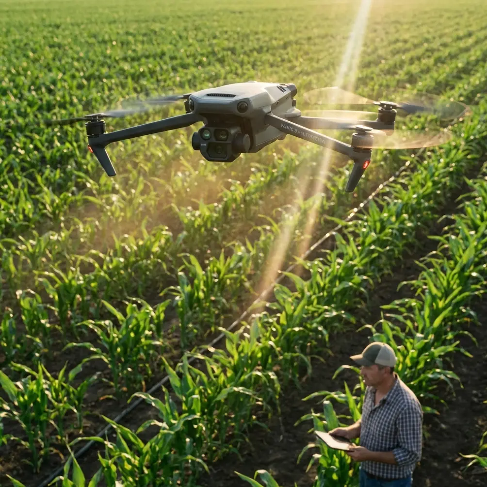
I have had venue jobs where the hardest part was not flying. It was getting consistent, usable footage from locations that were awkward to reach, difficult to preview from the ground, and too irregular for a simple orbit-and-done approach. Mountain lodges. Coastal retreat sites. Event spaces tucked behind tree lines or cut into uneven terrain. The common problem is access. You are usually making decisions with incomplete sightlines, changing weather, and limited time on site.
That is why the Mavic 4 Pro deserves to be discussed less as a spec-sheet object and more as a field tool. For remote venue work, the question is not whether it can capture pretty footage. Most modern prosumer aircraft can do that. The real question is whether it reduces uncertainty when you are trying to document a place that is physically inconvenient, visually complex, and often best understood from multiple angles.
That last phrase matters more than it seems.
DJI’s 2025 launch of the Zenmuse L3, described as its first long-range, high-accuracy aerial LiDAR system, was framed around daily aerial data collection, gathering information from multiple angles, and working in less accessible areas. On paper, that sounds far removed from a Mavic 4 Pro venue shoot. In practice, it points to the same operational truth: inaccessible locations punish one-dimensional capture. If a site is hard to reach, the value comes from building spatial understanding quickly, safely, and from varied perspectives.
The Mavic 4 Pro sits on the imaging side of that same logic.
Why remote venue capture is a different kind of assignment
A venue in a city center is straightforward. You can scout by car, walk the perimeter, check approach lines, and usually identify clean takeoff options. Remote venues are different. Access roads may be narrow, elevated, muddy, or lined with vegetation. Structures are often embedded in topography rather than standing apart from it. You are not just filming a building. You are trying to reveal the relationship between structure, landform, access path, parking area, surrounding view corridor, and the natural barriers that define the guest experience.
That means a drone has to do three things well.
First, it has to help you fly confidently near mixed obstacles. Trees, slope edges, utility lines, rock faces, and architectural elements often overlap in the same frame. Good obstacle avoidance is not a luxury here. It protects both the aircraft and the continuity of the job. On a remote assignment, a damaged drone is not just an equipment problem. It can mean the whole production collapses because there is no quick replacement run.
Second, it must maintain stable subject tracking without forcing you into repetitive paths. ActiveTrack is especially useful at venues where access roads, walking trails, or approach sequences tell the story better than static beauty shots. If the venue experience begins at a winding driveway or footpath, subject tracking lets you build movement into the sequence without making every shot feel manually wrestled into place.
Third, the image pipeline has to hold up under uneven light. Remote venues are often surrounded by forests, cliffs, water, or open sky. Contrast swings are severe. D-Log matters because venue marketing footage usually needs more than one delivery style. You might need a polished cinematic master, a flatter grade for a property brand team, and short social edits cut from the same flight. Log capture gives you room to protect highlights and shape the scene later instead of baking in a look you regret in post.
The past challenge that changed how I evaluate drones
One venue assignment still sticks with me. The site itself was excellent: a private event property set into elevated terrain with a tree-covered approach and a view that only revealed itself near the main structure. From the ground, the place felt dramatic. From the air, my first plan fell apart.
The access corridor was tighter than expected. A clean reveal shot needed a low, controlled move that threaded between trees before rising over the main building. The older aircraft I was using at the time could technically do it, but not with the confidence I needed. I ended up flying too conservatively, giving the client safe footage rather than footage that truly explained the venue.
That difference matters. Safe footage shows a property. Good footage communicates arrival.
This is where the Mavic 4 Pro class of aircraft changes the experience. Better obstacle awareness and more dependable intelligent flight behavior do not simply make flying easier. They let you attempt more informative compositions. That is a critical distinction. For remote venue capture, the best drone is the one that expands your practical shot list without increasing risk.
Multiple angles are not creative indulgence. They are operationally necessary.
The Zenmuse L3 launch language about collecting data from multiple angles is aimed at measurement-oriented work, but the principle carries directly into venue production. A remote venue is rarely understood from one hero shot. If access is difficult, people need orientation. They need to see approach routes, site scale, surrounding terrain, and the visual separation from nearby development. They also need to understand what parts of the site feel private, elevated, sheltered, or exposed.
With the Mavic 4 Pro, this means planning flights that are less about spectacle and more about layered comprehension.
A high establishing shot should define the venue’s position in the landscape.
A mid-altitude oblique should show how buildings sit within the site.
A lower lateral pass should reveal texture, circulation paths, and the sequence a visitor actually experiences.
QuickShots and Hyperlapse can help here, but only when used with discipline. Too many operators treat automated modes as shortcuts to visual polish. In remote venue work, they are more useful as repeatable movement tools. A well-chosen automated move can give consistency across multiple buildings or site segments, making the final edit feel coherent rather than assembled from random aerial fragments.
Hyperlapse is especially effective when the venue’s setting is part of its appeal. Cloud movement over hills, changing shadows across open grounds, or the gradual reveal of water or skyline context can all add location intelligence, not just atmosphere. The key is to use time compression to explain place, not distract from it.
Obstacle avoidance is really about decision quality
People often talk about obstacle avoidance as if it is only there for emergencies. That undersells its value.
In remote capture, obstacle sensing improves decision quality before a flight becomes critical. It allows you to focus more attention on line selection, framing, and timing because you are not mentally overloading yourself with pure collision anxiety. That matters when flying near irregular vegetation, boundary edges, pergolas, roof features, or terrain breaks.
For venue professionals, this can be the difference between making three cautious but generic passes and making one well-structured movement that actually sells the geography of the site.
It also supports solo operators. Many venue shoots are lean. You may not have a dedicated visual observer, a ground producer, and a spotter all working with you. A drone with robust obstacle management gives a solo creator a wider safety buffer while still respecting the discipline required by the environment and airspace.
ActiveTrack and subject-led storytelling
There is a temptation to think of subject tracking mainly in relation to athletes, vehicles, or lifestyle shoots. But for venue work, ActiveTrack can be one of the most practical storytelling tools on board.
A venue is experienced through movement. Guests drive in. Staff circulate. Visitors walk toward entry points, terraces, overlooks, or event lawns. Tracking a vehicle or walking subject on approach can translate scale far better than a static orbit of the main building ever will.
That is particularly true in remote locations, where the journey is part of the product.
A lodge hidden behind forest feels different from a hilltop event venue reached by a winding road. Subject-led aerial sequences communicate that difference fast. They help viewers understand remoteness, privacy, and access all at once.
The operational significance is straightforward: if the aircraft can hold tracking reliably while you maintain attention on composition and obstacle context, your margin for producing usable approach footage improves. That saves battery cycles and reduces the need for repeated runs, which is valuable when launch spots are limited and site logistics are messy.
D-Log is where technical capture meets client flexibility
Remote venues are notorious for difficult dynamic range. Dark roofs under surrounding trees. Bright horizon lines behind shaded architecture. Reflective water beside dense greenery. If you capture in a standard profile because it looks good on the monitor, you may be trapping yourself later.
D-Log changes that equation.
Not because log footage is magic, but because it preserves options. That matters when a venue operator wants one edit to feel warm and premium, another to look crisp and natural, and short-form clips to retain detail under aggressive compression. A properly exposed log workflow gives the post team room to recover sky detail, maintain texture in shaded facades, and keep color transitions cleaner across mixed lighting.
For creators working under real deadlines, that flexibility is practical, not theoretical. Remote shoots are hard to repeat. If the weather gave you one usable window, the file quality has to carry the project the rest of the way.
The bigger DJI signal behind the Zenmuse L3 launch
Even though the Zenmuse L3 is not a Mavic 4 Pro payload story, its launch says something useful about DJI’s direction. Aerial capture is being framed less as isolated image making and more as information gathering in difficult locations. The emphasis on long-range, high-accuracy capture, daily data collection, and work in less accessible areas reflects a broader expectation: aircraft should help operators understand places that are inconvenient, constrained, or partially hidden.
For venue creators, that mindset is worth adopting.
The Mavic 4 Pro is not a LiDAR platform, but the lesson is similar. Remote sites reward operators who think like surveyors of experience. You are not just collecting dramatic clips. You are building a reliable visual model of how the property sits, flows, and feels. Every feature that improves confidence across multiple angles, complex terrain, and limited access has outsized value in this type of work.
That is why the connection between these two DJI stories is stronger than it first appears. One is about precision spatial data. The other is about practical visual documentation. Both are responses to the same field reality: the places worth capturing are often the hardest to access and the hardest to explain from the ground.
A practical flight approach for remote venues
When I use a Mavic 4 Pro mindset on remote venue jobs, I work in layers.
First flight: orientation. High and conservative. Establish topography, wind behavior, obstacle clusters, and the venue’s relationship to roads or trails.
Second flight: structure and access. Focus on arrival routes, primary buildings, and the way guests move through the property. This is where ActiveTrack can earn its keep.
Third flight: signature movement. Use obstacle-aware lines for reveals, lateral passes, or low-height transitions that create emotional impact without forcing reckless proximity.
Fourth flight if needed: specialty material. Hyperlapse, alternate light angle, or short QuickShots for edit variety.
That sequence is not flashy, but it is efficient. It also reflects the same logic DJI highlighted with the Zenmuse L3: gather from multiple angles, solve for less accessible spaces, and make each flight contribute to a fuller understanding of the site.
If you are planning a remote venue workflow and want to compare setups or field considerations, you can reach me directly on WhatsApp here.
Final assessment
The Mavic 4 Pro makes the most sense for remote venue capture when you stop judging it by isolated features and start judging it by friction removed. Better obstacle avoidance reduces hesitation. ActiveTrack helps turn arrival and movement into usable story structure. D-Log protects hard-won footage when lighting is uneven. QuickShots and Hyperlapse, used selectively, add repeatable motion and context rather than filler.
And the broader significance of DJI’s 2025 Zenmuse L3 launch should not be missed. When the company emphasizes high-accuracy capture in less accessible areas and data collection from multiple angles, it is reinforcing a field principle that venue operators already know firsthand: the real challenge is not getting airborne. It is producing a clear, trustworthy, compelling view of places that resist easy documentation.
That is exactly where the Mavic 4 Pro earns its place.
Ready for your own Mavic 4 Pro? Contact our team for expert consultation.