Coastal Venue Photography: Mavic 4 Pro Expert Guide
Coastal Venue Photography: Mavic 4 Pro Expert Guide
META: Master coastal venue photography with the Mavic 4 Pro. Learn expert techniques for obstacle avoidance, D-Log color, and electromagnetic interference solutions.
TL;DR
- Electromagnetic interference at coastal venues requires specific antenna positioning and channel selection to maintain stable footage
- The Mavic 4 Pro's omnidirectional obstacle avoidance system prevents collisions with architectural elements and natural hazards
- D-Log color profile captures 14+ stops of dynamic range, essential for high-contrast beach and ocean scenes
- ActiveTrack 6.0 and QuickShots modes automate complex shots while you focus on composition
The Coastal Venue Challenge Every Photographer Faces
Coastal venue photography presents a unique paradox. You're working with some of the most visually stunning locations on Earth—dramatic cliffs, historic lighthouses, oceanfront estates—yet these environments actively fight against your equipment.
Salt air corrodes electronics. Unpredictable winds threaten stability. Electromagnetic interference from marine radar, radio towers, and underground power systems disrupts your signal.
The Mavic 4 Pro addresses these challenges through hardware innovations and intelligent software systems. This guide breaks down exactly how to leverage these capabilities for professional coastal venue work.
Understanding Electromagnetic Interference at Coastal Locations
Coastal venues sit at the intersection of multiple interference sources. Marine radar installations operate on frequencies that overlap with drone communication bands. Underground power cables running to lighthouses and historic buildings create electromagnetic fields. Even the mineral content in coastal rock formations can affect GPS accuracy.
Antenna Adjustment Protocol
The Mavic 4 Pro uses a dual-antenna transmission system operating on both 2.4GHz and 5.8GHz bands. When you encounter interference, the drone automatically switches between frequencies. But automatic systems have limits.
Start each coastal shoot with this antenna positioning sequence:
- Hold the controller with antennas perpendicular to the drone's position
- Avoid pointing antenna tips directly at the aircraft
- Maintain antenna angles between 45 and 90 degrees from horizontal
- Keep your body behind the controller to prevent signal absorption
When flying near radar installations or radio towers, manually select the 5.8GHz band through DJI Fly settings. This frequency experiences less interference from marine radar systems, which typically operate in the 2.7-3.1GHz range.
Expert Insight: Before any coastal venue shoot, use a spectrum analyzer app on your phone to identify active frequencies in the area. This thirty-second check has saved countless shoots from mysterious signal drops.
GPS and Compass Calibration
Coastal geology affects magnetic readings. Iron-rich volcanic rock, common along many coastlines, creates localized magnetic anomalies. The Mavic 4 Pro's dual GPS and GLONASS receivers provide redundancy, but proper calibration remains essential.
Calibrate your compass at least 50 meters away from:
- Metal structures and vehicles
- Underground power lines
- Large rock formations
- Concrete foundations with rebar
The aircraft uses Vision Positioning System (VPS) as a backup when GPS signals weaken. This system works effectively up to 30 meters altitude over surfaces with adequate texture and lighting.
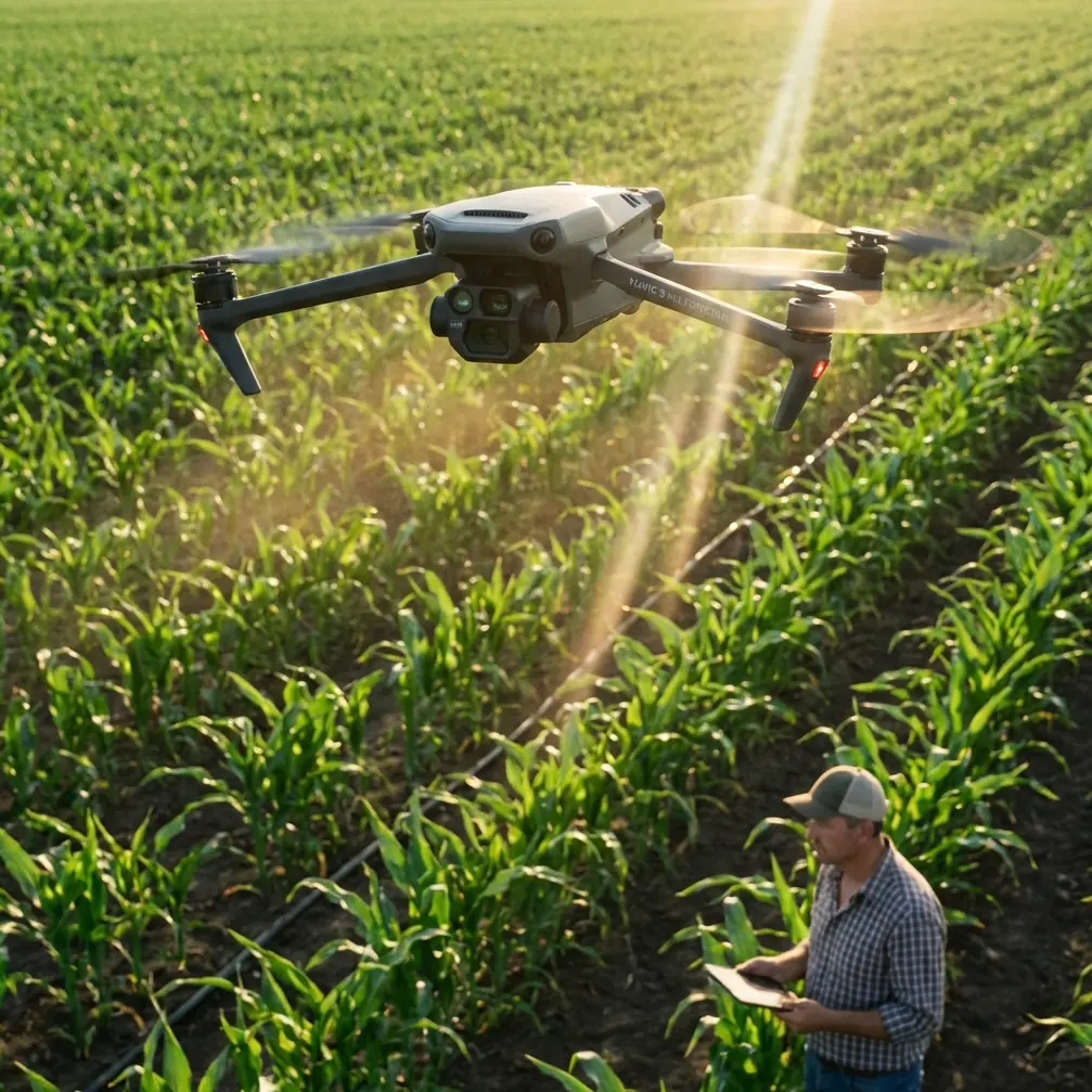
Mastering Obstacle Avoidance for Architectural Shoots
Coastal venues feature complex architectural elements—widow's walks, cupolas, weather vanes, flag poles. The Mavic 4 Pro's omnidirectional obstacle sensing uses a combination of wide-angle cameras and time-of-flight sensors to detect hazards in all directions.
Sensor Specifications and Limitations
| Direction | Sensing Range | Sensor Type | Effective Speed |
|---|---|---|---|
| Forward | 0.5-40m | Stereo Vision + ToF | Up to 15 m/s |
| Backward | 0.5-33m | Stereo Vision | Up to 12 m/s |
| Lateral | 0.5-33m | Stereo Vision | Up to 12 m/s |
| Upward | 0.2-10m | ToF | Up to 6 m/s |
| Downward | 0.3-18m | ToF + Vision | Up to 6 m/s |
These sensors struggle with certain obstacles common at coastal venues:
- Thin wires and cables under 8mm diameter
- Transparent surfaces like glass railings and windows
- Highly reflective materials including polished metal and water
- Low-contrast surfaces in fog or overcast conditions
When photographing venues with glass elements or thin architectural details, reduce your maximum flight speed to 8 m/s and increase your obstacle avoidance sensitivity to the highest setting.
Pro Tip: Create a mental map of all thin wires, guy-wires, and cables before launching. The obstacle avoidance system excels at solid structures but treats thin lines as invisible until dangerously close.
Subject Tracking for Dynamic Venue Reveals
The Mavic 4 Pro's ActiveTrack 6.0 system transforms how you capture venue reveal shots. Rather than manually controlling every axis of movement, you designate a subject—the main building, a distinctive architectural feature, or even a person walking the grounds—and the drone maintains framing while you focus on flight path.
ActiveTrack Modes Explained
Trace Mode follows behind or in front of your subject. Use this for walkthrough shots where a person guides viewers through the venue grounds.
Parallel Mode maintains a consistent lateral distance. This works exceptionally well for tracking along building facades, keeping the structure in frame while revealing its full length.
Spotlight Mode keeps the camera locked on your subject while you manually control the drone's position. This mode offers the most creative flexibility for complex architectural shots.
For coastal venue work, Spotlight Mode typically delivers the best results. You maintain complete control over the drone's spatial relationship to hazards while the gimbal automatically handles framing.
QuickShots for Efficient Coverage
When time constraints limit your shoot, QuickShots modes capture professional-quality sequences with minimal input:
- Dronie: Flies backward and upward while keeping the venue centered—perfect for establishing shots
- Circle: Orbits around a point of interest at a fixed distance and altitude
- Helix: Combines circular movement with ascending altitude for dramatic reveals
- Rocket: Ascends vertically while the camera tilts down, revealing surrounding landscape
- Boomerang: Creates an oval flight path around the subject
Each QuickShot can be customized for distance (up to 120 meters) and speed. For architectural work, slower speeds produce smoother footage that better showcases structural details.
Color Science: D-Log and Coastal Light
Coastal light presents extreme dynamic range challenges. Bright sand and water reflect intense sunlight while shaded architectural elements fall into deep shadow. The Mavic 4 Pro's 1-inch CMOS sensor captures this range, but only if you use the right color profile.
D-Log vs. Normal Color Profiles
The D-Log M profile preserves maximum dynamic range by applying a logarithmic curve to the captured data. This produces flat, desaturated footage that requires color grading but retains detail in highlights and shadows that Normal profiles clip.
| Characteristic | Normal Profile | D-Log M Profile |
|---|---|---|
| Dynamic Range | 11 stops | 14+ stops |
| In-Camera Look | Ready to use | Requires grading |
| Shadow Detail | Limited | Extensive |
| Highlight Recovery | Minimal | Significant |
| File Size | Standard | 15-20% larger |
| Best Use Case | Quick turnaround | Professional delivery |
For coastal venue photography, D-Log M captures the full tonal range of white-washed buildings against blue ocean, weathered wood textures in open shade, and the subtle gradations of sunset light on architectural surfaces.
Hyperlapse for Time-Based Storytelling
The Mavic 4 Pro's Hyperlapse mode captures the passage of time across coastal venues—clouds rolling over rooftops, shadows sweeping across courtyards, tides rising and falling against seawalls.
Four Hyperlapse modes serve different creative purposes:
- Free: Full manual control over flight path during capture
- Circle: Automated orbit around a central point
- Course Lock: Maintains heading while you control position
- Waypoint: Follows a pre-programmed flight path
For venue photography, Waypoint Hyperlapse produces the most consistent results. Program your flight path during optimal light, then let the drone execute the sequence automatically while you monitor from a safe distance.
Set your interval based on the movement you want to capture. Cloud movement typically requires 2-3 second intervals. Shadow movement needs 5-10 second intervals. Tidal changes demand 15-30 second intervals over extended periods.
Common Mistakes to Avoid
Ignoring wind patterns around structures. Coastal buildings create turbulent wind zones on their leeward sides. The Mavic 4 Pro handles up to 10.7 m/s winds, but turbulence near structures can exceed this even when ambient wind seems manageable.
Shooting during midday without ND filters. The sensor's minimum ISO of 100 and maximum shutter speed of 1/8000s still overexpose in bright coastal conditions. Pack ND8, ND16, and ND32 filters for proper exposure control.
Neglecting battery temperature. Cold ocean air reduces battery performance significantly. Keep spare batteries warm in an insulated bag. The Mavic 4 Pro's batteries perform optimally between 20-40°C.
Flying too close to salt spray. While the drone handles light moisture, salt spray corrodes electronics rapidly. Maintain at least 30 meters horizontal distance from breaking waves and avoid flying through sea spray.
Relying solely on automated modes. QuickShots and ActiveTrack produce consistent results, but they lack the creative decision-making that distinguishes professional work. Use automated modes for efficiency, then capture manual sequences for hero shots.
Frequently Asked Questions
How does salt air affect the Mavic 4 Pro's longevity?
Salt air accelerates corrosion on exposed metal components and can damage motor bearings over time. After every coastal shoot, wipe down the entire aircraft with a slightly damp microfiber cloth, paying special attention to motor housings and gimbal mechanisms. Store the drone with silica gel packets to absorb residual moisture. Professional coastal photographers typically budget for motor replacements every 150-200 flight hours in marine environments.
What's the best time of day for coastal venue photography?
The hour after sunrise and hour before sunset—known as golden hour—provides the most flattering light for architectural subjects. The low sun angle creates long shadows that emphasize texture and dimension. For venues with eastern exposure, morning light illuminates facades directly. Western-facing structures benefit from afternoon sessions. Overcast days work well for detail shots where you need even lighting without harsh shadows.
Can the Mavic 4 Pro fly safely in coastal fog?
Light fog reduces visibility but doesn't prevent safe operation if you maintain visual line of sight and reduce flight speed. The obstacle avoidance sensors perform less reliably in fog due to reduced contrast. Dense fog that limits visibility below 100 meters makes safe operation impractical. The moisture in fog can also affect motor performance during extended flights. Check weather forecasts and plan shoots for clear conditions when possible.
Ready for your own Mavic 4 Pro? Contact our team for expert consultation.