Capturing Remote Forest Landscapes with Mavic 4 Pro
Capturing Remote Forest Landscapes with Mavic 4 Pro: What Actually Matters in the Field
META: A field-focused Mavic 4 Pro article for remote forest shooting, with practical guidance on range discipline, obstacle avoidance, ActiveTrack, D-Log workflow, and why photogrammetry spacing standards still matter.
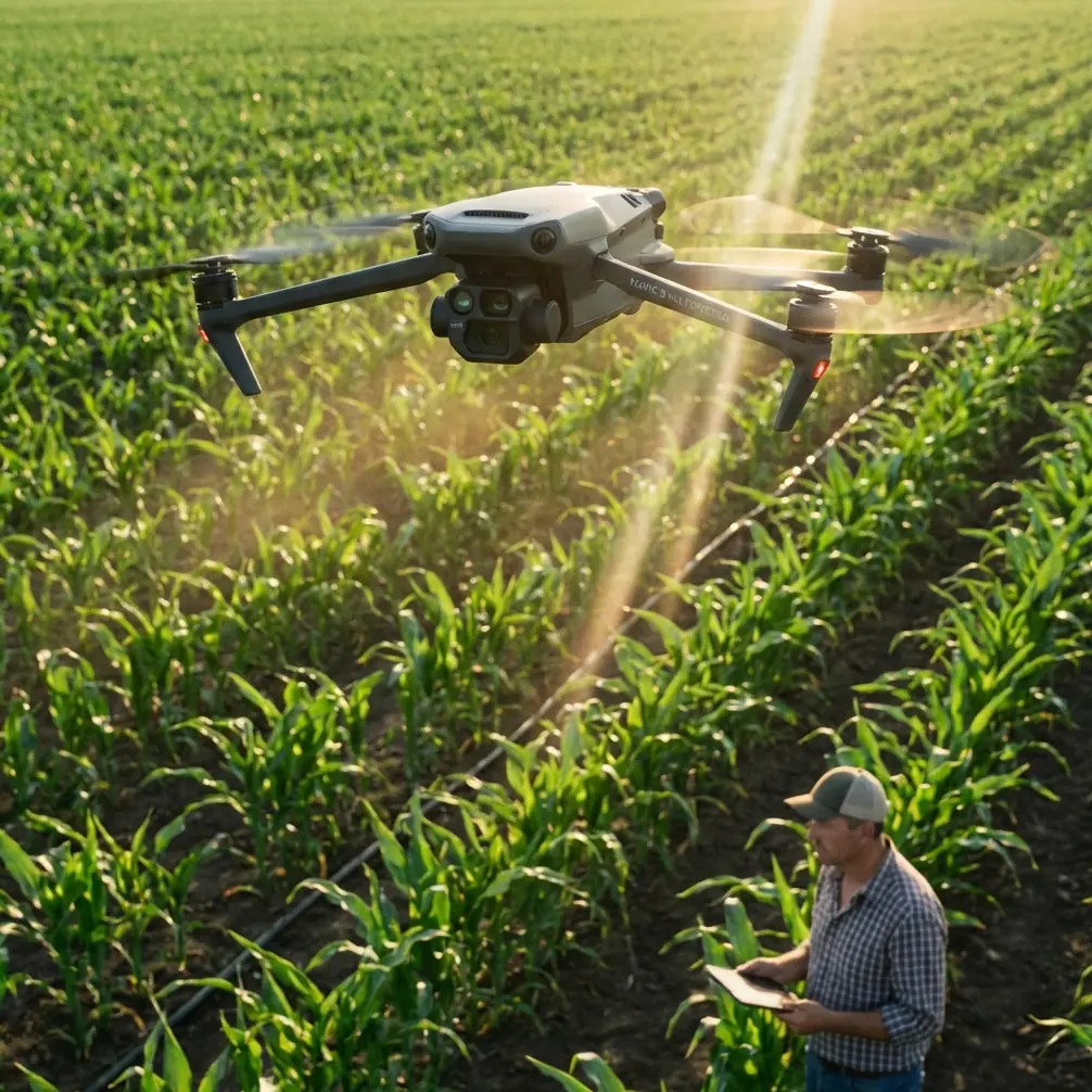
Remote forest work exposes a drone pilot fast.
Open farmland is forgiving. A coastal overlook gives you room to recover. Dense woodland does neither. Tree canopies interrupt line of sight, terrain changes fool your depth judgment, and moisture, shadow, and repeating textures can all make a beautiful location harder to fly and harder to map than it first appears.
That is where the Mavic 4 Pro conversation gets more interesting. Not because of hype, and not because every feature on the spec sheet deserves equal attention, but because remote forest capture demands a very specific blend of flight discipline, camera control, and planning logic. If you are trying to film, document, or survey wooded terrain in places where access is limited, the right habits matter more than the headline features.
I approach this as a photographer first. In forests, the job is rarely just “get a nice aerial shot.” It is usually one of three things: tell the shape of the landscape, reveal structure under difficult light, or bring back usable data from a place that is hard to revisit. Those are very different outcomes, yet they all depend on one basic truth: consistency in the air creates value on the ground.
The real problem in remote forests
The challenge is not simply distance. It is interrupted distance.
Forest environments break the clean assumptions that many pilots make in open terrain. Signal paths are less predictable when the aircraft dips behind ridgelines or when your own body position and controller angle work against you. Obstacle sensing has to deal with branches, trunks, layered canopies, and low-contrast scenes. Subject tracking can perform well in clearings and along edges, then struggle once a moving subject passes beneath uneven cover.
Even the camera side gets complicated. Forests often combine bright sky gaps with deep shadow, glossy wet leaves, and subtle tonal separation in greens and browns. If you expose carelessly, the footage looks flat in the shadows and harsh in the highlights. If you fly carelessly, you may come home with cinematic clips that are beautiful but impossible to stitch into anything measurable.
That last point deserves more attention than it usually gets.
Why an old photogrammetry standard still matters to Mavic 4 Pro users
One of the more useful reference points for serious aerial work comes from the Chinese low-altitude digital aerial photogrammetry field specification, CH/Z 3004—2010. The cited tables on page 14 deal with 1:2,000 mapping scale and the baseline span of elevation control points under two image orientations: one where the image short side is parallel to the flight direction, and one where the image short side is perpendicular to the flight direction.
At first glance, that looks far removed from a modern folding drone in a forest. It is not.
The table references different camera configurations such as the Canon EOS 5D, and it lists concrete spacing figures including 750 m, 923 m, 1,094 m, and 1,471 m. Those numbers are not there for trivia. They reflect a planning mindset: image geometry, flight orientation, and control spacing directly affect whether the final output is reliable.
For a Mavic 4 Pro operator working in remote woods, the operational lesson is simple: orientation and spacing are not abstract survey terms. They decide whether your flight produces repeatable coverage or a patchwork of beautiful but inconsistent imagery.
If your goal is forest documentation, habitat monitoring, slope condition review, trail corridor assessment, or visual reconstruction of a difficult site, you should think like a photographer and a mapping technician at the same time. A drone with smart features helps, but it does not replace planning around overlap, route consistency, and camera angle discipline.
Applying that logic in the forest
When flying over wooded terrain, many pilots improvise because the scene is dramatic. They chase openings in the canopy, orbit a ridge, then dip into a corridor and try a tracking shot on the way out. That can produce strong individual clips. It is also the fastest route to unusable coverage if you later need continuity.
The better approach is to separate your mission into layers.
First, capture your structured passes. Fly deliberate lines with consistent altitude relative to terrain as much as the route allows. Decide in advance whether your framing orientation favors travel direction or crosses it. That idea is directly connected to the reference standard’s distinction between short-edge parallel and short-edge perpendicular configurations. In practical terms, changing orientation changes how the landscape is sampled. In forests with repeating textures, that affects both visual readability and downstream stitching quality.
Second, once the repeatable work is done, switch to expressive shots. This is where the Mavic 4 Pro toolset earns its place. Use QuickShots sparingly, not as a gimmick but as a way to create smooth establishing motion after your essential coverage is secured. Hyperlapse can be effective over canopy movement or cloud shadow progression, but only if the wind is stable enough that the sequence feels intentional rather than jittery.
Third, plan for return limitations. A remote forest location often means you cannot easily walk to regain line of sight or recover from a poor route choice. That raises the value of preflight decisions.
Antenna positioning advice that genuinely helps
Most range problems in the field are not range problems. They are geometry problems.
In forest work, your controller antennas should be oriented so their broadside faces the aircraft rather than pointing the tips directly at it. Pilots often make this mistake when the drone is far out and slightly below the launch point. They instinctively “aim” the controller like a flashlight. That is usually the wrong move.
Instead, keep the antennas aligned to present the strongest transmission pattern toward the aircraft’s position. Then adjust your own stance. Turn your body, raise the controller above chest level if needed, and avoid standing behind a vehicle, metal railing, rock wall, or dense vegetation cluster that can partially block the signal path. In rolling forest terrain, moving just a few meters sideways to clear a trunk line or ridge shoulder can make a larger difference than any settings change.
This matters because remote woodland flights often fail gradually, not dramatically. You do not always get a sudden disconnect. You get a weaker image feed, more hesitation in control response, and less confidence in obstacle judgment. Good antenna positioning buys you stability before you need it.
If you want field-specific setup advice for difficult terrain, this direct WhatsApp line is useful: message a drone specialist here.
Obstacle avoidance is valuable, but don’t ask it to be magic
Forest flying is where obstacle avoidance earns respect and reveals its limits.
The Mavic 4 Pro’s obstacle avoidance and route intelligence are especially useful when transitioning between open clearings and tree-lined approaches. Branches, partial canopy edges, and sudden elevation changes are exactly the kind of variables that can catch out even experienced pilots when they are focused on composition. A good sensing system reduces workload.
But you still need to fly with a margin.
Thin branches, cluttered backgrounds, and dark understory zones are difficult visual conditions for any autonomous system. Morning fog, wet bark, or strongly backlit leaves can also reduce scene clarity. In practice, this means obstacle avoidance should be treated as a protective layer, not your primary navigation strategy.
I tell forest shooters to define two routes mentally: the shot path and the escape path. The shot path is what you want. The escape path is the cleanest vertical or reverse route if the aircraft behaves unexpectedly or if the scene closes in faster than it looked on the screen. In a forest, those two paths are rarely the same.
ActiveTrack and subject tracking in woodland scenarios
ActiveTrack-style subject tracking can be excellent for trail runners, cyclists on forestry roads, utility inspection teams moving along access paths, or a slow-moving vehicle entering a remote site. But the choice of subject and background matters.
Tracking works best when the subject has visual separation from the environment. On a pale dirt road under even light, performance is usually more stable. Under broken canopy with mottled shadow, where a dark jacket blends into a dark trail and branches repeatedly cross the frame, the system has more work to do.
The operational takeaway is to simplify the scene for the aircraft. Start tracking in an open segment. Give the system a clean lock. Keep your initial speed moderate. If the route passes into heavy canopy, be ready to take over before the aircraft is forced into a late correction.
That is especially relevant for remote forest filming because the prettiest tracking segments are often the least forgiving. The drone may hold the subject well, but that does not guarantee the surrounding space remains safe.
D-Log is not optional if you care about forest tonality
Forests punish compressed color.
If your footage includes bright sky windows through the canopy and deep shade below, a flatter recording profile like D-Log gives you room to recover detail and preserve smoother tonal transitions. This is one of the most practical reasons serious Mavic 4 Pro users lean into a color-managed workflow rather than relying on a straight-out-of-camera look.
In woodland scenes, the issue is not just dynamic range. It is color separation. Greens can merge into one another quickly, especially when humidity softens contrast. Bark, soil, moss, and water reflections all sit close together tonally. D-Log helps keep those relationships pliable in post.
For photographers crossing into data-adjacent missions, that matters more than style. Better tonal control improves interpretability. A washed-out patch of canopy or crushed shadow around a drainage line is not merely less cinematic; it may hide the exact surface detail you needed to review later.
QuickShots and Hyperlapse have a place, but timing matters
Remote forests tempt pilots into dramatic automation too early.
QuickShots are best used after your safe corridors are understood. A reveal move over a tree line or a slow pullback from a ridgeline can establish scale beautifully, but only when the aircraft has enough clean air to execute without the scene boxing it in. Hyperlapse can turn moving mist, changing light, or a treetop wind pattern into something special, yet it demands a stable hover environment and careful battery awareness.
The practical rule is easy: automated creativity comes after manual certainty.
If you are on a one-trip mission in a hard-to-access forest zone, your first responsibility is coverage integrity. Once that is secured, the expressive features become an advantage rather than a distraction.
What experienced operators do differently
The pilots who get the most from a Mavic 4 Pro in remote woodland settings are rarely the ones who fly the most aggressively. They are the ones who maintain structure.
They think about image orientation before takeoff. They preserve overlap when they may need reconstruction later. They know that a standard discussing 1:2,000 mapping scale and control-point baseline spans is not irrelevant history but a reminder that aerial results depend on geometry. And they respect the significance of concrete spacing values like 750 m or 1,471 m not as fixed numbers to copy blindly, but as evidence that mission design has to be quantified.
That same mindset carries into signal management. Antenna position is deliberate. Launch location is chosen for visibility, not convenience. Tracking is started where the subject is easy to isolate. Obstacle avoidance is enabled, but the pilot still leaves room. D-Log is selected because the forest will need it later, not because it sounds advanced.
That is what separates casual forest footage from dependable aerial work.
The Mavic 4 Pro is at its best in remote natural environments when you stop thinking of it as a flying camera that happens to have smart features, and start using it as an imaging platform that rewards discipline. In forests, that distinction changes everything.
Ready for your own Mavic 4 Pro? Contact our team for expert consultation.