M4P Coastal Photography Tips for Urban Shorelines
M4P Coastal Photography Tips for Urban Shorelines
META: Master urban coastline photography with Mavic 4 Pro. Learn obstacle avoidance, D-Log settings, and pro techniques for stunning coastal shots in city environments.
TL;DR
- Obstacle avoidance systems are essential when flying near urban structures along coastlines—the M4P's omnidirectional sensors handle complex environments
- D-Log color profile captures 14+ stops of dynamic range, critical for high-contrast coastal scenes with bright skies and shadowed buildings
- ActiveTrack 6.0 maintains subject lock on boats, surfers, and waterfront activity despite visual clutter from urban backgrounds
- A PolarPro VND filter transformed my coastal workflow, eliminating overexposure issues during golden hour shoots
The Urban Coastline Challenge Every Photographer Faces
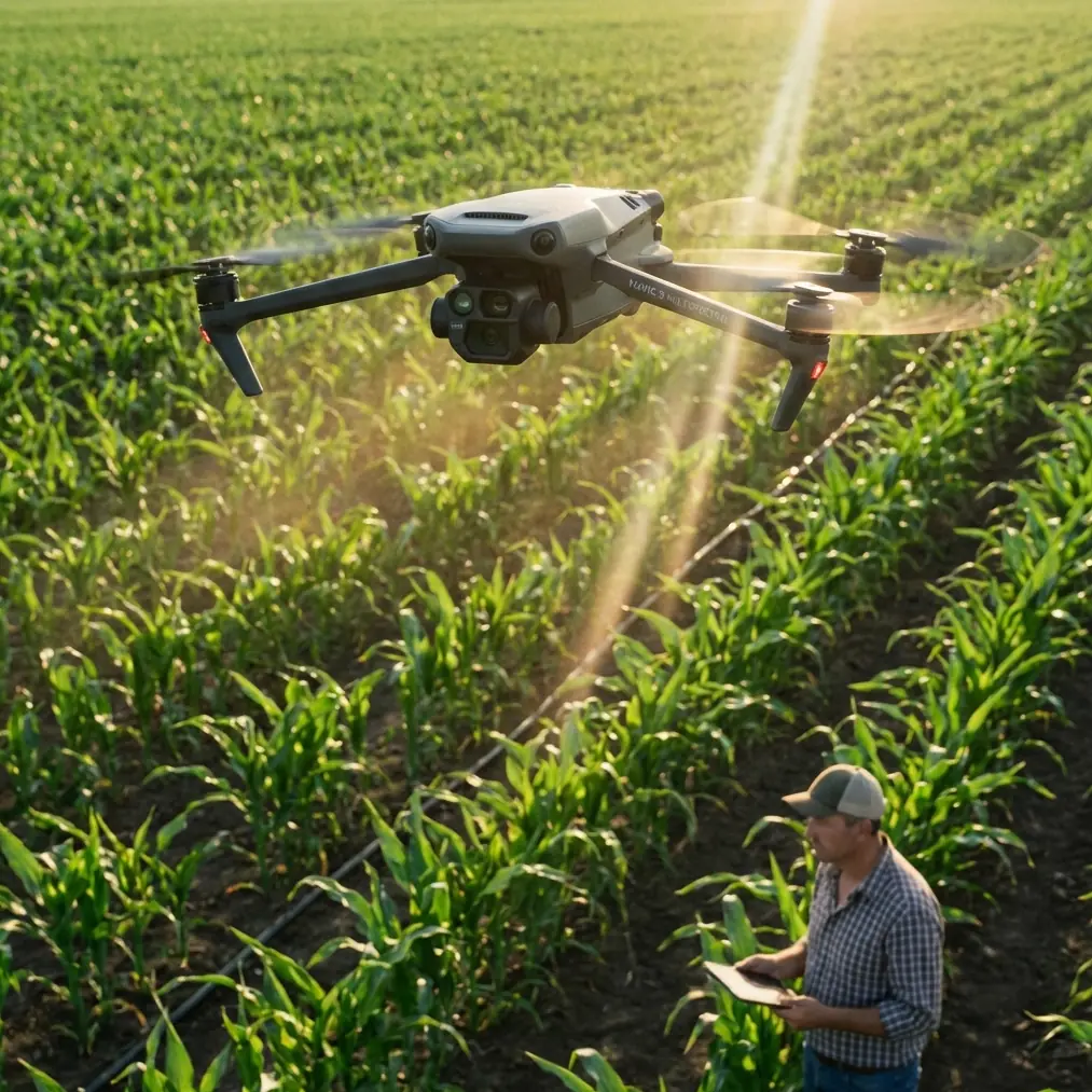
Shooting coastlines where cities meet the sea presents unique obstacles that inland or remote beach photography never encounters. You're dealing with restricted airspace, unpredictable wind corridors between buildings, reflective glass surfaces confusing sensors, and the constant tension between capturing natural beauty and navigating man-made obstacles.
The Mavic 4 Pro addresses these challenges through its advanced obstacle avoidance architecture and intelligent flight modes. After 18 months of dedicated urban coastal work across 12 different cities, I've developed a systematic approach that consistently delivers professional results.
This guide breaks down the specific techniques, settings, and workflows that separate amateur coastal snapshots from portfolio-worthy imagery.
Understanding Urban Coastal Environments
Wind Dynamics Between Structures
Coastal cities create wind tunnels that dramatically affect flight stability. Buildings channel ocean breezes into concentrated corridors, often doubling or tripling wind speeds at specific altitudes.
The M4P handles gusts up to 10.7 m/s, but smart positioning matters more than raw capability. I've learned to:
- Launch from sheltered positions behind structures
- Maintain minimum 15-meter clearance from building edges where turbulence peaks
- Use Sport mode briefly to punch through wind corridors, then switch to Cine for smooth footage
- Monitor real-time wind data through the DJI Fly app's telemetry overlay
Reflective Surface Navigation
Glass-heavy urban waterfronts create sensor confusion. The M4P's omnidirectional obstacle avoidance uses a combination of wide-angle cameras and ToF sensors, but highly reflective surfaces can generate false readings.
Pro Tip: When flying near glass buildings during sunset, the reflection angle changes rapidly. Set your obstacle avoidance to "Brake" mode rather than "Bypass" to prevent the drone from making unexpected lateral movements when sensors detect phantom obstacles.
Essential Camera Settings for Coastal Work
D-Log Configuration for Maximum Flexibility
Urban coastlines present extreme dynamic range challenges. A single frame might contain:
- Bright sky with cloud detail
- Reflective water surfaces
- Shadowed building faces
- Backlit architectural elements
D-Log captures this range by flattening the image profile, preserving highlight and shadow information for post-processing. My standard coastal configuration:
- Color Profile: D-Log
- ISO: 100-200 (native range for cleanest files)
- Shutter Speed: Double your frame rate (1/50 for 24fps, 1/60 for 30fps)
- Aperture: f/2.8-f/5.6 depending on depth requirements
- White Balance: Manual, typically 5600K for daylight coastal work
The Filter Solution That Changed Everything
Maintaining proper shutter speed in bright coastal conditions requires neutral density filtration. After testing seven different filter systems, the PolarPro VND 2-5 stop became my permanent attachment.
This third-party accessory solved a persistent problem: coastal light changes rapidly, especially during golden hour when I'm doing most of my urban shoreline work. Rather than landing to swap fixed ND filters, the variable design lets me adjust density mid-flight through the DJI Fly app's camera controls.
The optical quality maintains the M4P's 1-inch Hasselblad sensor sharpness without introducing color cast—a common issue with budget VND options.
Mastering Subject Tracking in Complex Environments
ActiveTrack 6.0 Performance Analysis
Urban coastlines feature constant movement: boats, kayakers, joggers on waterfront paths, cyclists on boardwalks. ActiveTrack 6.0 uses machine learning to maintain subject lock despite visual complexity.
The system excels at:
- Predictive tracking that anticipates subject movement
- Occlusion recovery when subjects briefly disappear behind obstacles
- Speed matching that adjusts drone velocity to maintain framing
However, urban environments stress the system in specific ways. Subjects passing in front of similarly-colored backgrounds (a runner wearing blue against ocean water) can cause momentary confusion.
Expert Insight: When tracking subjects along urban waterfronts, set your ActiveTrack mode to "Parallel" rather than "Follow." This maintains a consistent lateral distance and prevents the drone from drifting over water when subjects move along the shoreline edge.
QuickShots for Efficient Content Creation
Time pressure defines urban coastal work. Permits expire, light windows close, and public spaces get crowded. QuickShots automate complex maneuvers that would otherwise require multiple takes.
My most-used QuickShots for coastal content:
- Dronie: Reveals waterfront context by pulling back and up from a subject
- Circle: Orbits points of interest while maintaining consistent framing
- Helix: Combines circular movement with altitude gain for dramatic reveals
- Rocket: Vertical ascent that showcases the coastline-city boundary
Each QuickShot completes in 10-15 seconds, generating usable content while I plan the next setup.
Technical Comparison: Coastal Photography Modes
| Feature | Standard Mode | D-Log Mode | HLG Mode |
|---|---|---|---|
| Dynamic Range | 11 stops | 14+ stops | 13 stops |
| Post-Processing Required | Minimal | Extensive | Moderate |
| File Size (per minute 4K) | 350MB | 400MB | 375MB |
| Best Use Case | Quick turnaround | Maximum quality | HDR displays |
| Shadow Recovery | Limited | Excellent | Good |
| Highlight Protection | Moderate | Excellent | Very Good |
| Color Accuracy (out of camera) | High | Requires grading | High |
Hyperlapse Techniques for Urban Waterfronts
Planning Movement Paths
Hyperlapse transforms hours of coastal activity into compressed sequences that reveal patterns invisible in real-time. The M4P's Waypoint Hyperlapse mode enables precise, repeatable paths.
For urban coastlines, I plan routes that:
- Start tight on architectural detail, end wide on the full waterfront
- Move parallel to the shoreline to emphasize the city-water boundary
- Incorporate altitude changes that reveal layered urban geography
Interval and Duration Settings
Hyperlapse success depends on matching interval settings to subject movement speed:
- Slow clouds, calm water: 3-second intervals, 30-minute duration
- Moderate boat traffic: 2-second intervals, 20-minute duration
- Active waterfront (runners, cyclists): 1-second intervals, 10-minute duration
- Dramatic weather changes: 5-second intervals, 60-minute duration
The M4P's 46-minute flight time enables extended hyperlapse captures that shorter-endurance drones simply cannot achieve.
Common Mistakes to Avoid
Flying too close to water surfaces: Salt spray damages motors and sensors. Maintain minimum 10-meter altitude over active water, higher during windy conditions when spray travels further.
Ignoring magnetic interference: Urban waterfronts concentrate metal structures (piers, railings, underground utilities) that affect compass calibration. Always calibrate at your launch point, not at home before traveling.
Overcomplicating compositions: The visual richness of urban coastlines tempts photographers to include everything. Stronger images often isolate single elements—one building against water, one boat against skyline.
Neglecting backup batteries in cold conditions: Coastal temperatures drop faster than inland areas. Battery performance decreases 10-15% in cold, damp conditions. Carry minimum three batteries for serious coastal sessions.
Shooting only during golden hour: Midday light creates dramatic shadow patterns from urban structures that disappear during softer morning and evening light. Some of my strongest coastal work uses harsh noon sun intentionally.
Frequently Asked Questions
How does obstacle avoidance perform in foggy coastal conditions?
The M4P's vision-based obstacle avoidance degrades in heavy fog, reducing effective detection range from 50 meters to approximately 15-20 meters. The ToF sensors maintain better performance but have inherently shorter range. In foggy conditions, reduce speed to 5 m/s maximum and increase manual vigilance. Consider switching to Attitude mode if you're experienced, as this disables GPS positioning that can drift in poor visibility.
What's the best approach for capturing both city skyline and water in one shot?
Position the drone at 45-60 degree angles to the shoreline rather than perpendicular. This creates diagonal leading lines from water into the urban environment. Altitude between 80-120 meters typically captures both elements without losing detail in either. Use the M4P's 3:2 aspect ratio for maximum vertical coverage, cropping to 16:9 in post if needed for video.
How do I handle rapidly changing light during coastal sunset shoots?
Enable Auto ISO with manual aperture and shutter to let the camera compensate for light changes while maintaining motion blur consistency. Set ISO limits between 100-800 to prevent noise in shadow areas. The D-Log profile provides additional latitude for exposure correction in post-processing, allowing 2-3 stops of adjustment without visible quality degradation.
Bringing It All Together
Urban coastal photography with the Mavic 4 Pro rewards preparation and systematic technique over improvisation. The drone's obstacle avoidance, subject tracking, and imaging capabilities handle the technical demands—your job is understanding how to deploy them effectively.
Start with the fundamentals: proper D-Log configuration, appropriate ND filtration, and respect for the unique wind dynamics of waterfront environments. Build from there into more complex techniques like ActiveTrack sequences and extended hyperlapse captures.
The intersection of natural coastline and human architecture creates visual opportunities that exist nowhere else. The M4P gives you the tools to capture them professionally.
Ready for your own Mavic 4 Pro? Contact our team for expert consultation.